Southern Labrador.
Summer 2009.
With few deciduous, colour-changing trees in Newfoundland, autumn is marked by it growing too cold to do anything at night & the sun setting at earlier and earlier times. That enjoyable mid 60s temperature of early September starts to delve into the 40s and you know that the onslaught of winter is soon forthcoming.
The days weren't exceptionally cold yet, but daily temps were dipping enough to motivate me into trying to get a few last things done with the passing weekends.
Northern Newfoundland is linked by a ferry line which connects it to Southern Labrador. Without much reason besides the fact that it was unexplored Southern Labrador, the trip up & across was added to my list.
I can't recall why I resolved that I should visit Southern Labrador before the upcoming winter, but I did. I checked some of the weather forecasts and the temperatures seemed to be at least tolerable with preparations.
(Aside: if you're looking at that above map and your astute self is wondering why I didn't just take the ferry from Lewisporte (represented by the dotted line (the one out in the Atlantic)), it's because that ferry is expensive, 24 hours long and has far less adventure than driving up the Northern Peninsula.)
Plus there's more excitement in Southern Labrador as a whole, then what you would find in just visiting Cartwright.)
The only ferry crossing times from Northern Newfoundland to Southern Labrador were either 8 a.m. or 3:30 p.m. on Friday; and 8:00, 1:00 or 6:00 on Saturday. Since I didn't want to take the Friday off, I planned on taking the Saturday 8:00 a.m. ferry.
This meant I would be sleeping in St. Barbe (where the ferry leaves the Island of Newfoundland) and waiting for the boat in the morning. Driving in the middle of the night to get to St. Barbe at 8 in the morning was out of the question because of the high amount of moose & caribou present on this stretch of highway...and also because I just didn't feel like driving through the night.
Anyway, the drive from Corner Brook to St. Barbe doesn't have much for destinations which I haven't seen yet. The drive is quite desolate anyway; in addition to the fact that this would also be my 5th trip through this corridor.
I eventually found something interesting and hoped that I could cover the 328km(203mi) to the New Ferolle Lighthouse before the sunset (or hopefully AS the sun set).
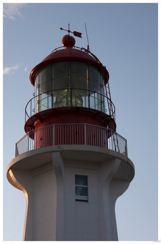
I worked through lunch so that I could leave at 3:30 and I still made it just in time.
After turning off the north-south Highway 430, the 21km road which leads to the lighthouse is entirely east-west. Driving west on that highway, I had the sun setting in front of me and as I watched it falling towards the horizon, I increased the speed and skill with which I was driving.
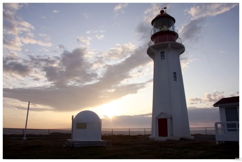
New Ferolle, built in 1913, is standard issue for many Atlantic Canada Lighthouses: about 50-70 feet tall, white with red lantern, stone, triangular arch over doorway, 2 or 3 windows, 10 feet wide, etc., etc.
Even with New Ferolle being so cookie cut, the scene of arriving as the sun set with not another person for a good 2 kilometres was a beautiful thing. Also of note is that this lighthouse is still active, so the fresh paint and maintenance of the Coast Guard was definitely appreciated by this visitor.
I loitered and wandered about for a good 20 minutes, enjoying myself at the lighthouse.
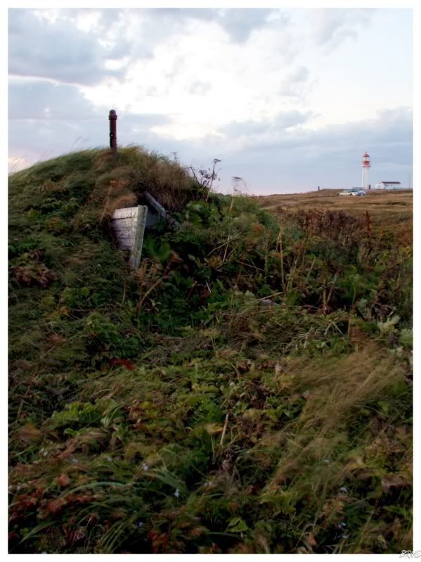
As I begrudgingly left and departed back for the highway, I caught this root cellar out of the corner of my eye. I've read about and seen pictures of root cellars at various places in Newfoundland prior to this - so I was excited to finally find my own.
I don't really know what I expected to find inside, but it was, as you could guess, an empty cement square with a dirt floor.
Regardless, I still liked my root cellar.
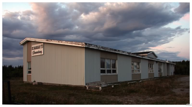
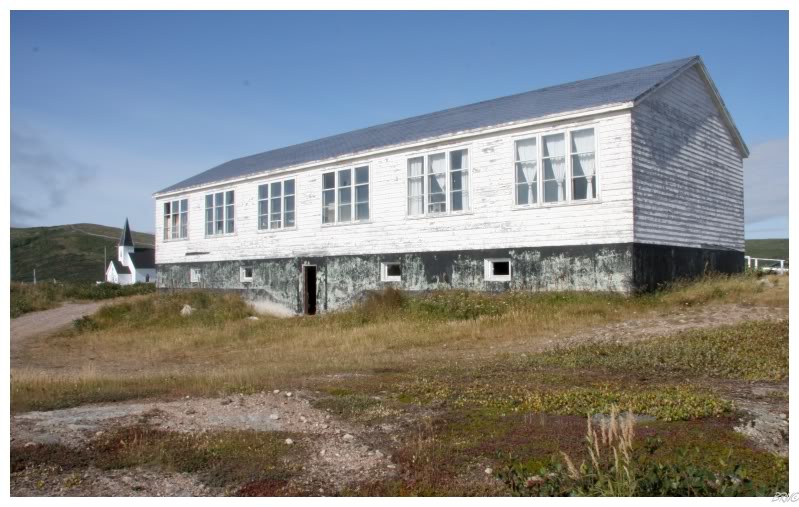
There was also an old elementary school which caught my eye while initially driving to New Ferolle.
Creeping around, I eventually peered inside to find the school was now the storage site for some fisherman's ropes, traps, nets and other various fishing paraphernalia.
Oh Newfoundland.
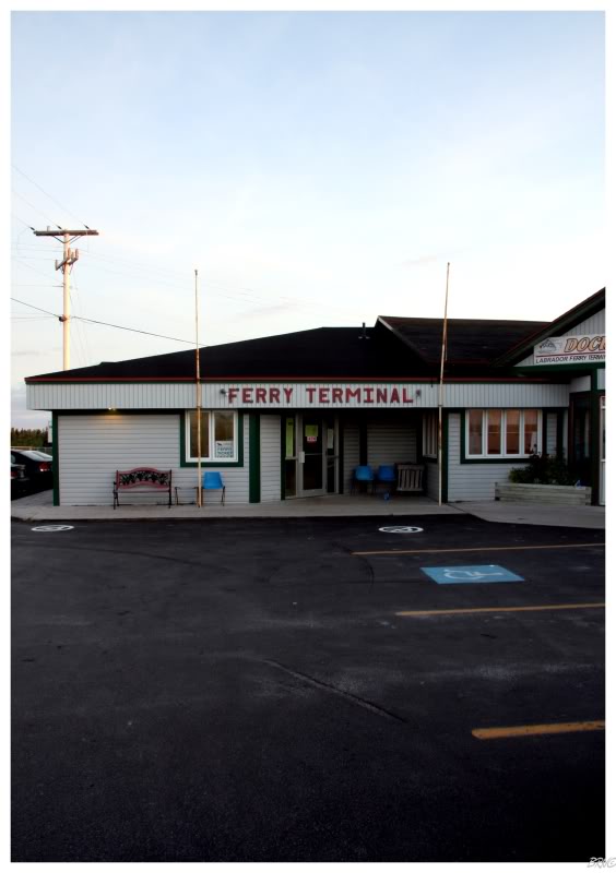
New Ferolle to St Barbe (where the ferry leaves Newfoundland) is a mere 49km(30mi), so even though I took my time, I still found myself in St Barbe around 9 o'clock, without much to do besides wait for the 8 a.m. ferry.
I've been trying to resolve to travel cheaper, but I broke down and decided to go inside the motel. Thankfully, the motel ended up being $120 for the night and I quickly found myself back inside my car for the night. I spent the next few hours using the ferry terminal's internet to watch episodes of High Stakes Poker, while eating dill pickle chips and drinking back Pineapple Crush. Once my computer battery died, I decided to call it a night and sleep about as well as you can when people are constantly moving around the ferry terminal and attached motel.
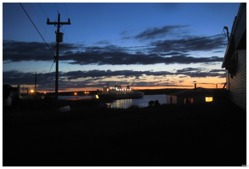
The above picture comes around sunrise. I got 5 total hours of sleep, but I never fell deeply into slumber. Therefore when I woke up for the 11th time and saw this scene before me; I decided I had enough sleep and took to snapping pictures, accompanied by the cold light of morning.
I love walking around places in the early morning, everything cast in a red hue...everything so quiet and peaceful.
And that's exactly what I did with my first morning hour in St. Barbe.
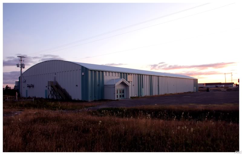
What you see in the second picture is the St. Barbe Arena: the only arena between Gros Morne Arena and St. Anthony Olympia.
After walking around, I had barely enough time to eat before boarding the ferry.
Although a bit chilly, I couldn't complain at all about the weather on this fine day.
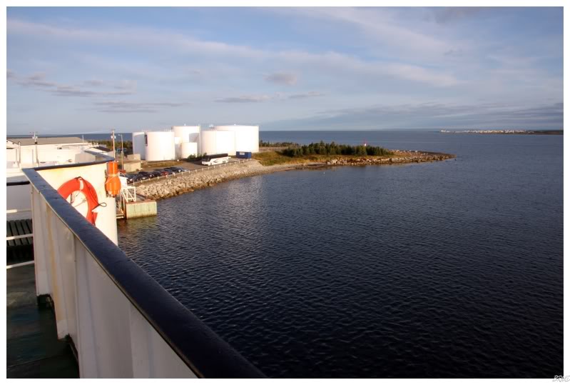
After the ship escaped the bay of St. Barbe into the open waters, I moved inside and took to exploring the ship.
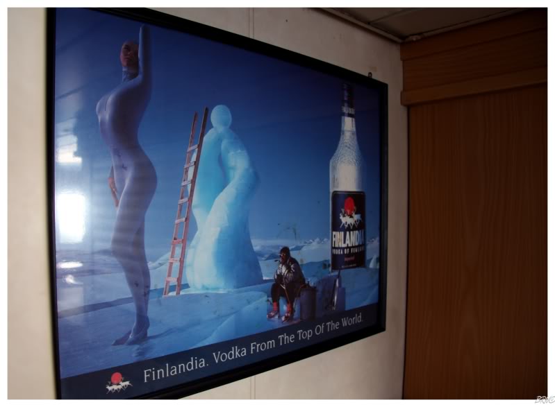
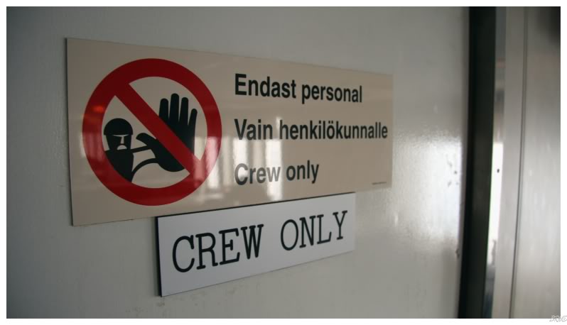
Some of the other intra-provincial ferries I've been on in this province were stripped down to the bare bones, but I really enjoyed the Scandinavian liquor ads and European signs which still adorned the St. Barbe to Blanc Sablon ferry.
Q: Why does a Newfoundland ferry have Scandinavian liquor ads and European signs?
A: Newfoundland sometimes purchases ships from Scandinavian countries to use in any of the numerous intra-provincial ferry routes.
If you're wondering as a result: the ship wasn't outdated or anything, I would actually say it was quite nice.
The crossing is 1.75 hours each way, so I eventually wore myself out and sat down in the main viewing room.
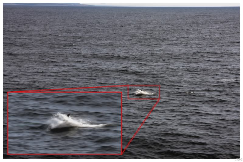
Since I had my company's dSLR with me, a young man came over and told me that he just saw a whale swim beside the ferry and then go underneath it - just in case I wanted to go outside to take a picture.
I ecstatically thanked the guy before making it outside and peering out into the ocean for about 8 minutes with the guy. He saw one which I didn't, then I saw my first and he saw it too.
I viciously snapped pictures and this was the best I came up with. The original picture isn't cropped at all, so I suppose it isn't that bad, but I learned this day that taking pictures of sea creatures is an exercise in patience...and I have the patience of a 5 year old spoiled child.
I stood on the deck for a bit longer, not seeing anymore whales, but instead watching an Arctic Tern follow our ferry across the Strait of Belle Isle.
After returning to my seat, I was amused while overhearing an American couple talking to a born and bred Labradorian. The Americans were obviously enamored with his accent and wanted to hear Newfie things; getting their wish when the Labradorian described his hometown of St. Lewis as so barren that a Blue Jay has to pack a lunch when it moves from tree to tree.
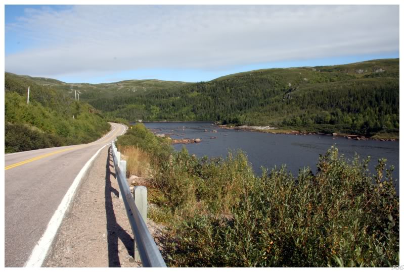
Since I hadn't previously researched the land cover, I suddenly picture a vast barren wasteland - which was completely squashed when I landed in Blanc Sablon. The above picture is from the highway north to Red Bay; and as you can see, there is plenty of trees and shrub and other places for Blue Jays to have their lunch.
(St. Lewis is a good 200km north of this).
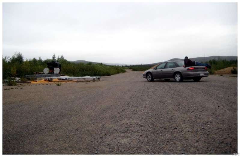
Before moving to Newfoundland, my use of gravel roads was solely reserved to secondary or even tertiary roads serving a few farmers in Southern Ontario - then Newfoundland opened my eyes to the use of gravel roads for highways; just highways where there isn't enough population.
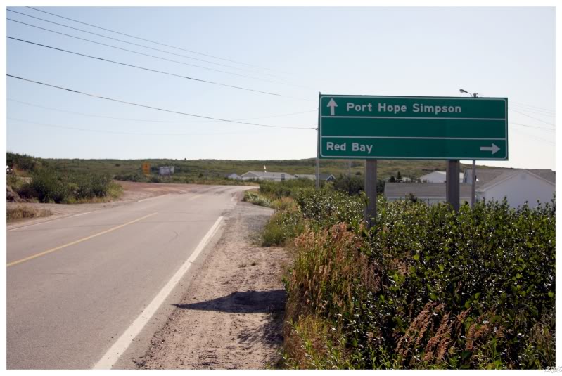
I knew that I would have to drive on the gravel Trans Labrador Highway if I wanted to reach Cartwright, but I sort of doubted that it started in Red Bay - only 81km (50mi) from the Labrador/Quebec border and the ferry terminal.
But there I stood, I was in Red Bay and the internet hadn't lied - the road north was a rough gravel road to Port Hope Simpson (and further to Cartwright).
I wasn't quite ready to tackle that gravel road yet, so I decided to explore Red Bay.
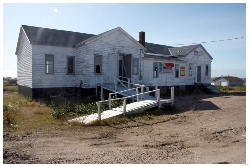
Red Bay is the site of a historic whaling settlement from the 1500s and they're attempting to acquire UNESCO World Heritage Status. This store which caught my eye had building eaters in front of it and I figure the two things were related - i.e. that eyesore building needs to go to impress the UNESCO people.
The place looked interesting enough, while the family down the street paid me no mind; so I decided to get out and take some pictures.
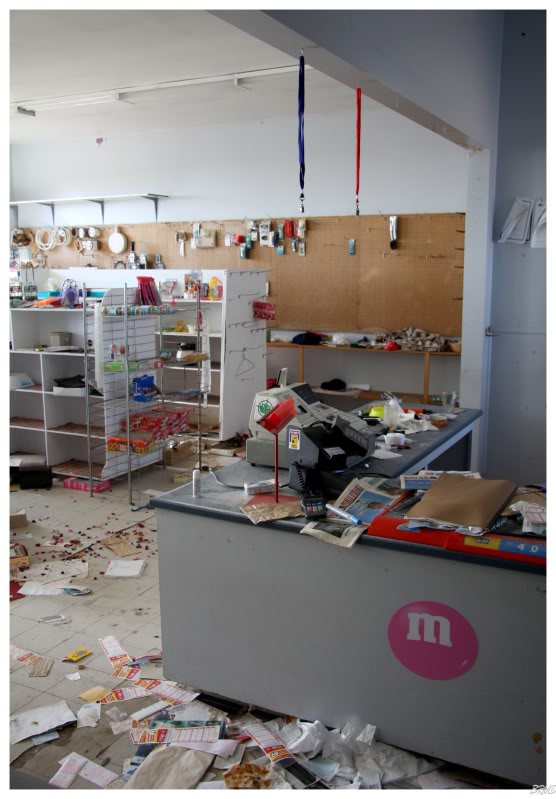
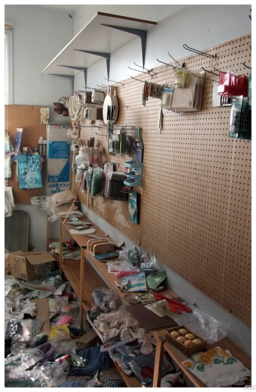
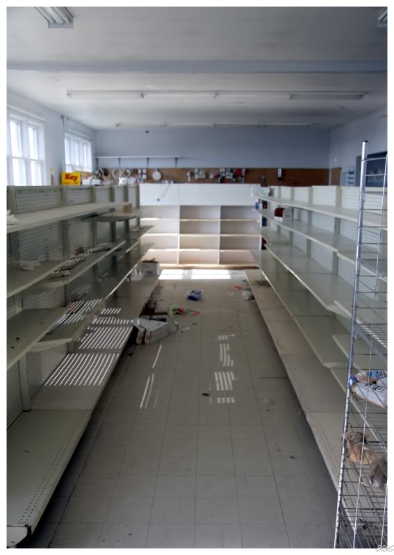
I've been inside an abandoned convenience store before, but never one with so much original stuff still on the shelves.
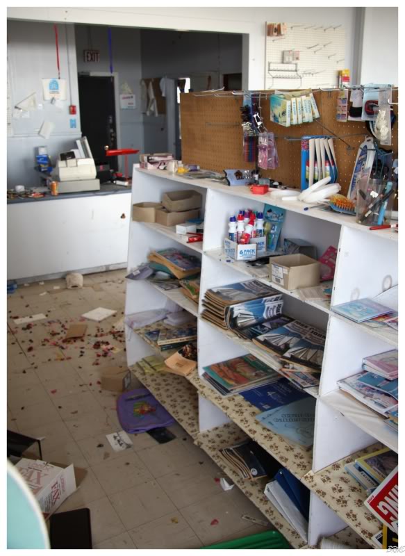
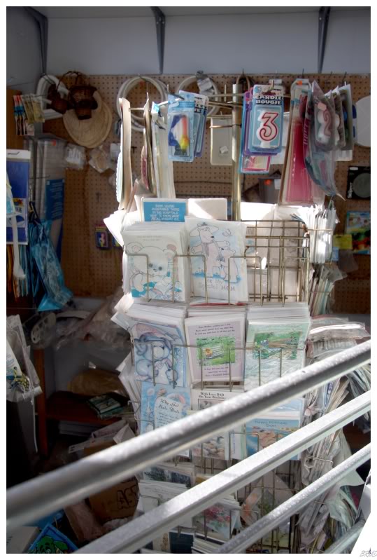
I contemplated sending one of the cards to my Mom for her upcoming birthday, but I didn't think she'd see the beauty in a sun worn and disintegrating card.
The building looked more interesting than a grocery store on the outside and I hoped to find out its history once I got home - but the internet let me down as there's no listings for Red Bay on the Provincial National Historic Structures web site.
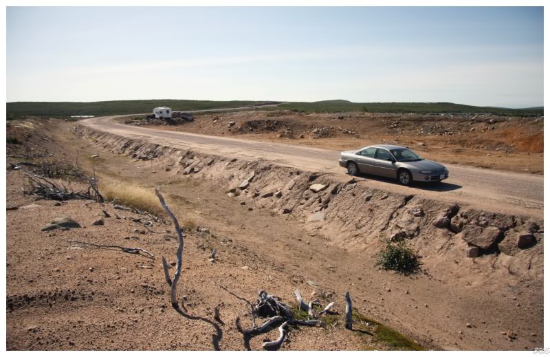
I filled up on gasoline and snacks at the local convenience store to support Red Bay. The store's parking lot was literally in the shadow of the gravel road sign, so once I pulled out of the store's lot, it was onto the gravel road headed north.
My initial reaction was that the road was pretty smooth and that there was also a relatively high amount of traffic. Within the first 10 kilometres (6mi), I saw 4 or 5 other cars and I wondered just how busy the road actually was.
Somewhere during this wondering, a dude in a truck tailed me for about 10 seconds before speeding by me - appalled at my 70km/hr pace.
The cars thinned out after the first few kilometers as you can imagine. The first portion of the highway was very green with medium shrubs and foothills surrounding me, with a river following me for 10 or 15 minutes of that travel. This section ended as the land started to become devoid of substantial vegetation and resembled something more similar to the above picture.
It was also about this time that I lost my last radio station. Deciding against charging my laptop and/or mp3 player was a smart decision, right?
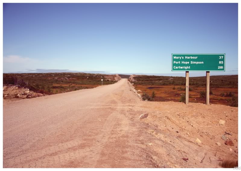
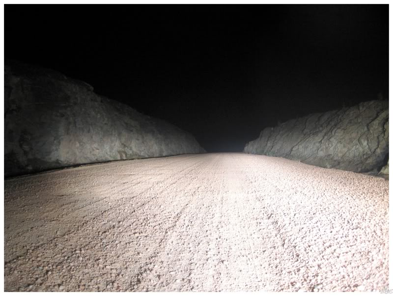
The above picture indicating 281 kilometres (~180mi) to Cartwright wasn't even the start of the gravel road - this picture actually comes from right after the above, above picture - once I decided to pull over and take a break after 60 kilometres of the gravel pleasure.
Meaning the length of gravel road from Red Bay to Cartwright is 341km (211mi).
After Red Bay, Route 510 only has 4 communities on it; with 2 more if you want to count those which you can reach off of branching highways. Even though there were only 4 communities, I passed right by Mary's Harbour - reasoning that Port Hope-Simpson was only another 50 kilometres.
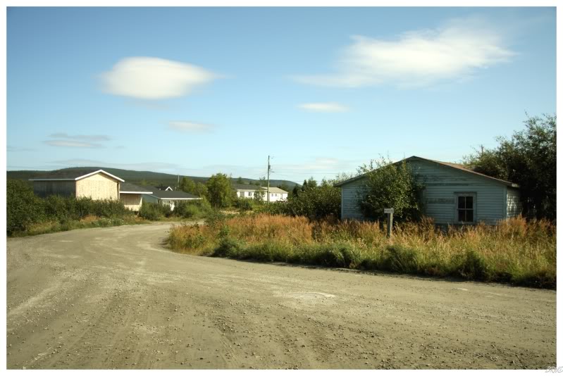
The fact that I didn't have any radio was starting to wear on me before Port Hope Simpson thankfully came along. The road curves left and you suddenly have an overlook as the road sloped downwards and you assume that the town will appear soon, a large river standing to your right. A couple of minutes later and you squeeze right and Port Hope-Simpson is before you. It is a little more developed than the above picture would portray, but it is still what you would expect from a former company town which had trouble even gaining town status or access to the outside world.
I stopped for some more gas and one of these delicious pre-wrapped sandwiches they have here in Newfoundland. I have no idea how they get them everywhere, but somehow they're just as good in Port Hope-Simpson as they are in St. John's.
Stepping to the counter, I decided to try my luck in hopes that maybe this store had some lingering stock of cassette tapes for my car - to no avail. The woman mildly scoffed at the notion and I tried to explain that I thought they may have had some laying around from a long time ago. It was pointless, it blew her mind that I thought she would have cassettes and I just went on my way, not before picking up an awesome Labrador magnet for the old man.
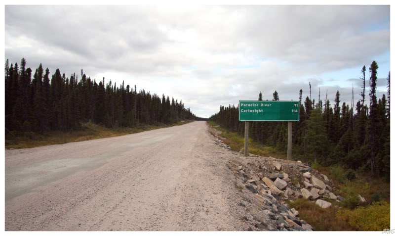
After Port Hope Simpson, there isn't another community until Paradise River, which is just before Cartwright. The distance between Port Hope-Simpson and Cartwright measures 197km (122mi), and after crossing the impressive Port Hope-Simpson bridge, it is an extra large serving of spruce trees and barren land.
By this time, I had grew quite comfortable with the gravel road and was putting the Intrepid in cruise control at 100km/hr (60mi/hr) speeds. After seeing how terrible some of the paved Newfoundland 'highways' are, I was strikingly impressed with the maintenance and quality of this gravel road.
Anyway, I had picked up another radio station around Port Hope-Simpson, so that was helping. The above picture was about halfway to Cartwright, when I needed to escape Canadian talk radio and get out of the car for a minute. The station in Red Bay was actually good, but this new Port Hope-Simpson radio station was mediocre at best - with Sook Yin Lee of MuchMusic fame hosting some show about something or other.
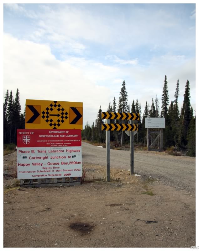
As I neared Paradise River, I came to the junction where the Trans Labrador Highway is being extended to Goose Bay - which will also connect Southern Labrador to Labrador City and Quebec.
Coming from a place like Ontario, it's neat to live in a place where towns are actively being abandoned, highways are being built and big decisions are being made - in Ontario, this all seems established already; while in just 2 years of Newfoundland, I've seen places resettled and the opening of a new highway from Cartwright to Goose Bay (the highway was completed in December; it only had 20 kilometres (13mi) left to connect when I took the above picture).
I considered driving on the highway for a bit, but I didn't really have spare time to allocate to such a trivial task.
Instead I turned right and after another 50 kilometers (30 miles)...
...I was the most northern I have ever been in my life!
I thought Goose Bay, Labrador, a place in Central Newfoundland...which I flew in to, would have been the most northern place I'd ever been to; but it was surprisingly south of Edmonton! Thankfully the Hamilton Strait angles southwest from Cartwright to Goose Bay - meaning Cartwright is actually north of Goose Bay.
Although I already ruined the surprise, Cartwright is also north of Edmonton! Checking the unquestionable Wikipedia, we see that Cartwright is 1/6th of a latitudinal degree north of Edmonton - the equivalent of how much more north Detroit is to Trenton(MI), Wallaceburg is to Windsor, Gloucester is to Boston and the Halifax Airport is to Halifax.
In laymen's terms: I had a new northern maximum by a hair.
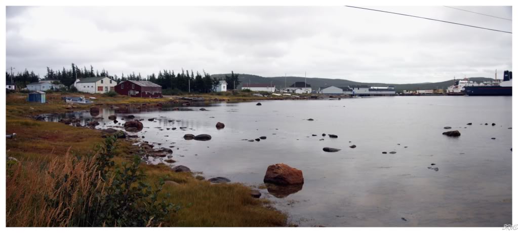
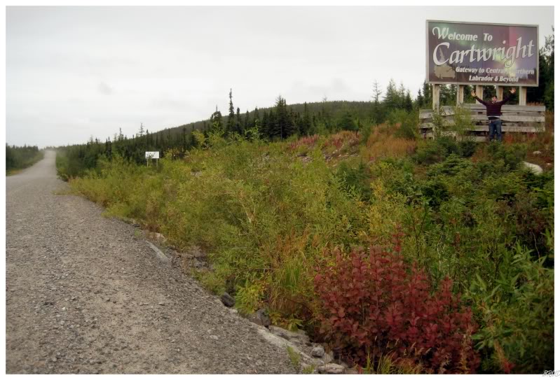
Cartwright is actually a sizeable town with a population of 628 and many structures. I figured the place to be substantial because it's a stopover point for the ferry, and simply because of how much I'd heard of Cartwright during my time in Newfoundland.
Unfortunately for me, it is also very flat and spread out; which always provides a challenge for anyone trying to convey the size of a community with a picture.
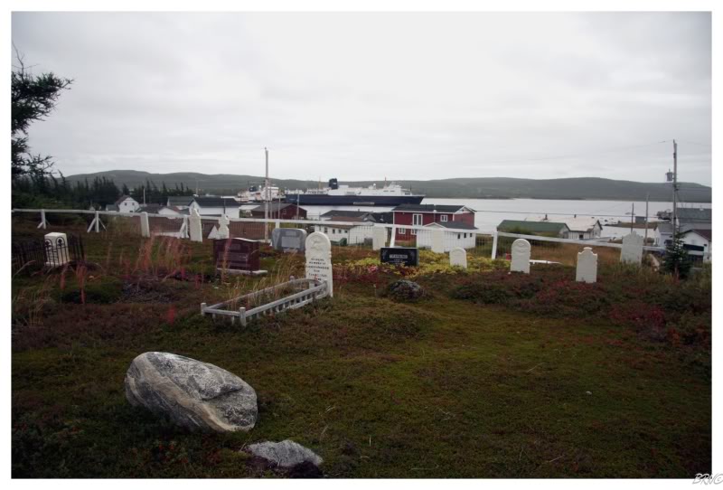
There was a cemetery which seemed to be elevated and would provide a good vantage point, but it wasn't much better than anywhere else.
As I walked through the graveyard, I noticed a lot of the stones were Davis's. So I began looking for a Steve Davis for my friend Steve Davis, but to no avail.
When I told him about this, he gave me that, you're a weirdo get away from me look.
Moving right along...
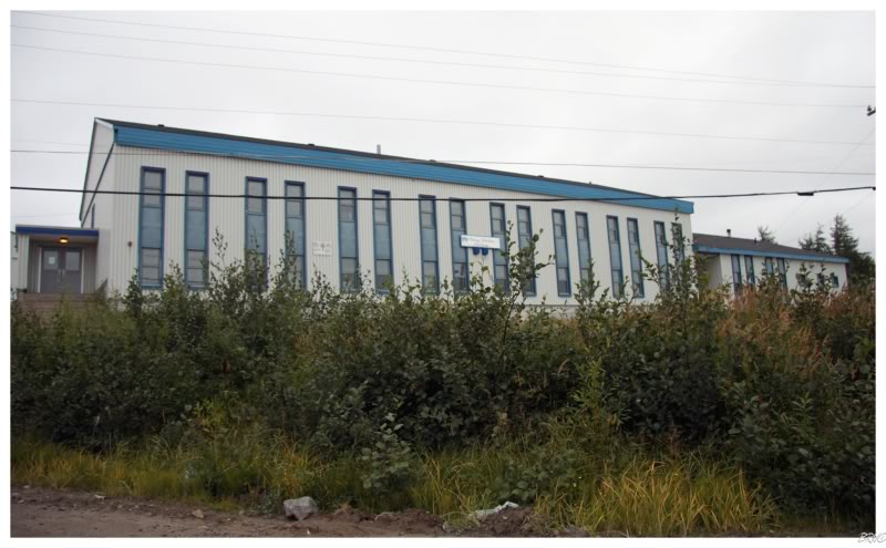
The local high school in Cartwright.
I actually had an unstated motive for trying to rush to Cartwright during the daylight as it is the site of another one of those former Pinetree Radar Sites (see: 1, 2, 3). Situated at the top of a small mountain and a fair hike from the town, I drove the Intrepid past the reasonable portions of the dirt road and even some of the unreasonable portions. Once I couldn't stand giving her any more punishment, I pulled off as far as I could and began walking the way which I believed would lead me to the Pinetree site.
Walking along the path, I eyed the site up on the mountain - one which would probably have taken approximately an hour each way. Since it was already 6 o'clock by this time - and I needed to get back towards Red Bay tonight, I had to abandoned the idea of the Pinetree Site.
Hopefully there will be another chance someday.
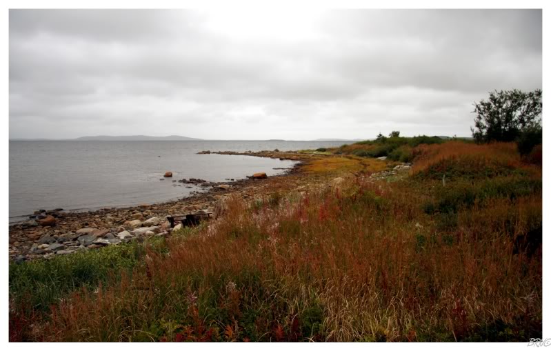
Instead, because I was only a hundred metres from the ocean, I followed the path to the above secluded rock beach you see; before turning around and heading back to the town site and then out of Cartwright.
Our time together was too short Cartwright.
What happened to Paradise River you ask?
Well, I skipped right past it on the way to Cartwright, as it is very rarely referenced and has a population of 18. I figured that I could check it out quickly on the way back, after climbing to the radar ruins in Cartwright.
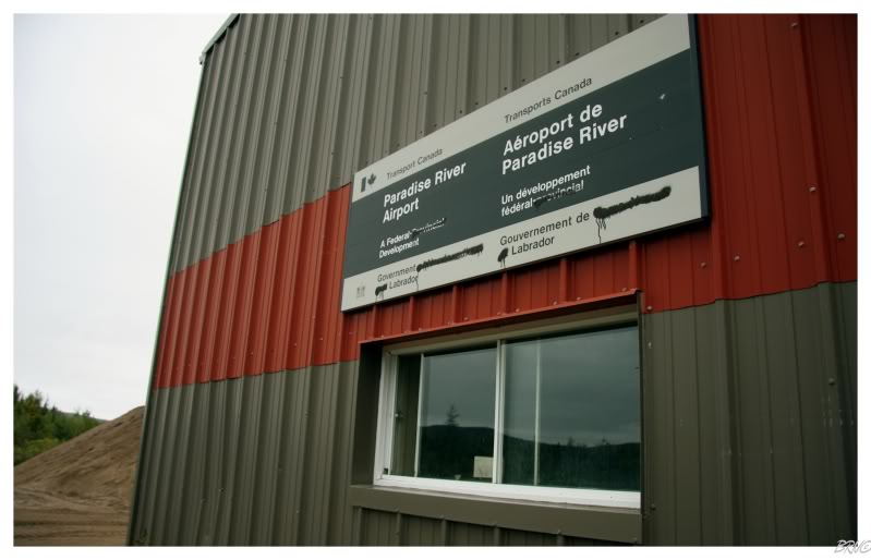
Anyway, as I slowed to turn off at Paradise River (the road doesn't go directly through Paradise River), I grew surprised at the site of an abandoned airport (think airstrip). How the hell did I miss this on the way to Cartwright? What else am I missing in my travels?
After briefly checking out the actual hamlet of Paradise River, I found a nice little community, but I was more than excited to get back to the airstrip - an abandoned airstrip has long been something I've wanted to check out.
Since I didn't see one person in the town, I casually parked out front and began taking pictures of the vandalized sign. The fact that the painters scribbled out 'Newfoundland' in 'Newfoundland and Labrador' caused me to ponder Labradorians opinion about their counterparts on the island.
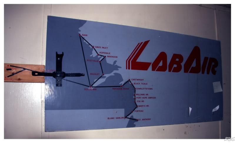
I was certain that I wouldn't be able to get into the airport building, but sure enough I did. I was greeted by a sign informing me that I'm not allowed inside without the permission of Wade, but I was just taking pictures, so I didn't want to call Wade and bother him at home during this hour.
Away from the neat Lab Air poster, there wasn't much in the building besides maintenance reports and miscellaneous handyman items.
That was alright though, because the reason I always wanted to find an abandoned airstrip was to drive on the airstrip itself!
I'm not one to beat on my car, so I sped around a little, gradually turned around and posed for a picture.
Anyway, that was enough Paradise River fun, the sun was setting and I wanted to have as much sunlight to drive as possible.
Which wasn't very much.
After leaving Paradise River, the light disappeared quickly as the sky was overcast and the sun was blocked earlier than it would have been on a cloudless sky. The 160-something kilometre (100 mile) drive from Paradise River was done mostly in the dark and without the radio for a great portion. I had been up since 6 a.m. and had already drove a substantial amount today. The road wore on me more and more. The signs denoting the distance to Port Hope-Simpson didn't show the numbers falling quickly enough and I grew more and more frustrated.
This frustration was alleviated for a minute as I finally crossed the Port Hope-Simpson bridge into the town; but was quickly reacquired as I entered the town hotel and proceeded to ring the bell and look around for anyone working. I knew the hotel would cost around $120, even as I registered at 12 at night, which I had to accept - but when that fact was coupled with no one being able to help me for the 10 minutes I stood at the counter like a fool?
I stormed out of the hotel and it was back onto the highway. I had a coffee and some black Halls from the store in Port Hope-Simpson, so I was somewhat ready for the 140 (km) trip to Red Bay...or at least the 50 (km) trip to Mary's Harbour.
Reaching Mary's Harbour was a slight challenge with the rain and my level of fatigue. I had begun to fall asleep as I neared Mary's Harbour, so I decided to go into the town and see about some accommodations. Again I was met with $125 rooms and again, I decided against it.
I parked my car in Mary's Harbour and caught a couple hours of sleep, awakening every 20 minutes or so as the town beacon would illuminate the sleepy village.
Sometime around 4 or 5, I decided to conquer the rest of the distance to Red Bay. I felt a little better & I was mostly in that state where you're not falling asleep, but you're not entirely there. I stopped about halfway to Red Bay and you see my tripoded picture above - an interesting fact is that those rock cuts are where you see those 'look at Canada's crazy winter' e-mail pictures from: these rock cuts harbour incredibly deep snow which makes for good pictures to scare the Yankees.
I reached Red Bay, and I'll forever remember vividly the quiet jubilation in my soul when my car finally hit that smooth pavement; the rattling and jiggling of the gravel road ending at last.
I drove another 30km to the community of Pinware, where I finally required more sleep - pulling the car over in front of the community hall and watching as the drops slowly obscuring my surroundings. It was only 38° this night and I was thankful I had my solar blanket.
Even with that solar blanket, I was waking up at intervals whenever a part of my body would escape its cover and grow cold. I started my car once for heat, but overall, the solar blanket did a good job of keeping me warm as I huddled in the driver's seat of my mid-size sedan, surrounded by the darkness and silence of Labrador.
Onto Day2.
(There's more to this story and it will come in a couple days.)
Sources:
1 - The Atlas of Canada - CB to Cartwright Map
2 - Yvonne Jones, Liberal Member of the House Assembly - Communities
Navi