An American Visitor to the Rock - Day 3
Summer 2009.
Day 3 - St. Anthony to Corner Brook - 430mi/700km (We take a different route back)
I was up early the next day and harassed the hippy enough until she got out of bed.
We had a big day ahead of us after all!
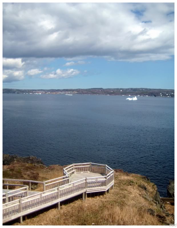
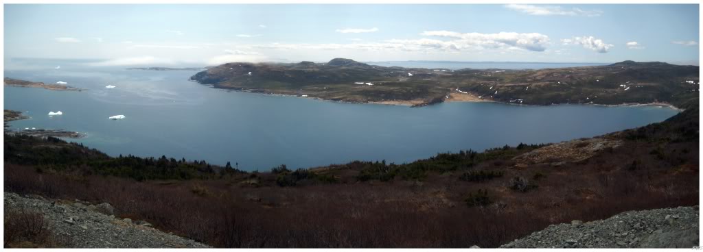
The first stop of the day was another lighthouse since there's one right in St. Anthony. Before even moving towards the lighthouse and about 10 seconds after parking the car, BOTH of us saw a first...
Iceberg!
Icebergs are great and all...but really, they're just pieces of ice out in the harbour. A really small one, really far from our side of the shore wouldn't hold our attention for that long...
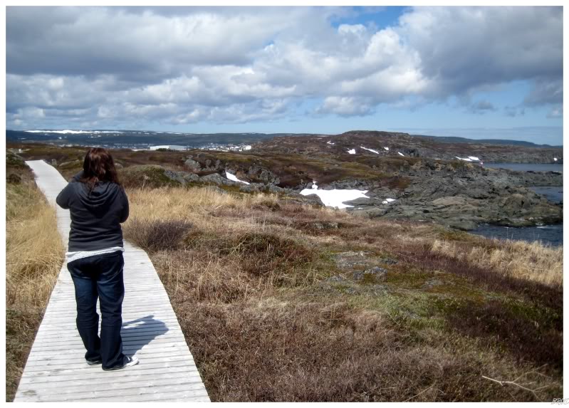
...and so, Kristen was quickly distracted by the fact that there was still snow on the ground and it was mid June.
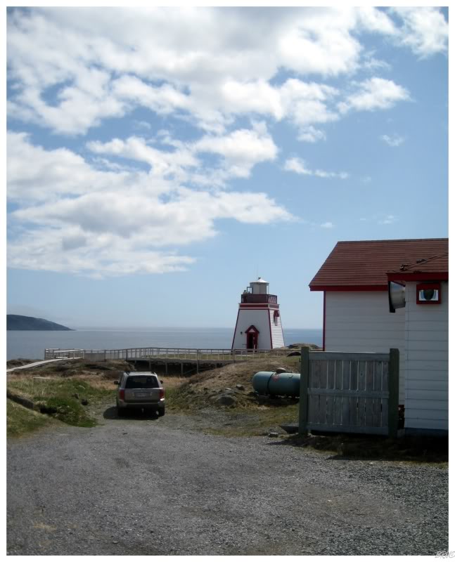
Continuing on the boardwalk, we came to the St. Anthony lighthouse; which doesn't look like much from the outside...
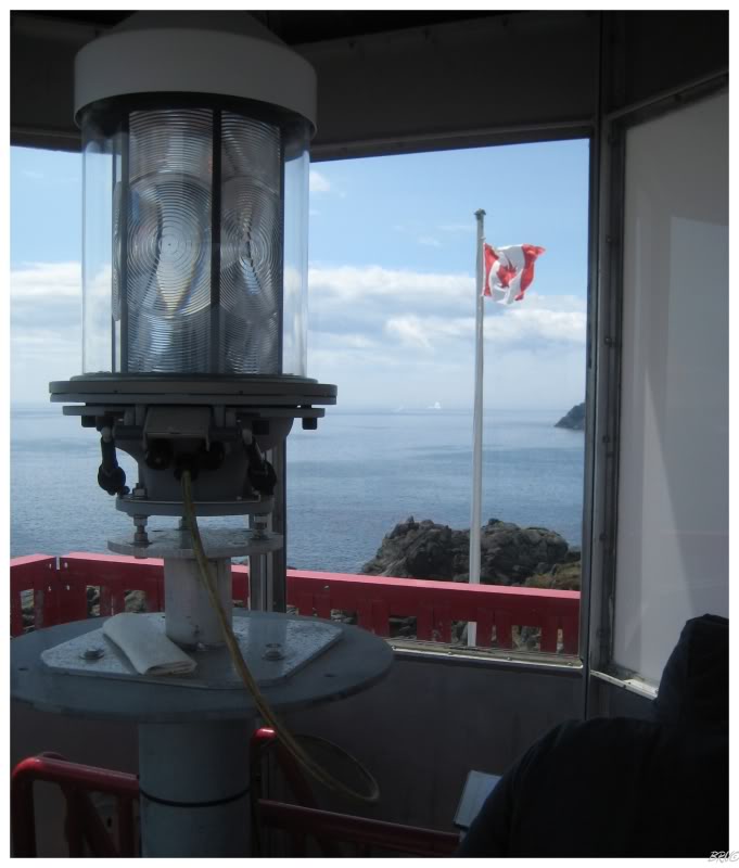
...but is actually surprisingly impressive inside!
As we were walking up, the two lighthouse keepers were showing a group out and were about to go to lunch. They asked us if we could come back and at this point we learned that you could actually see the interior of the lighthouse.
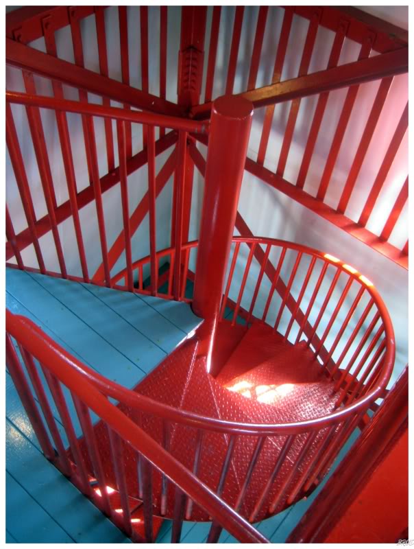
Since we were leaving right after the lighthouse, the keepers postponed lunch for a few minutes and let us ascend the red spiral staircase to the top of the lighthouse.
The fact that we were leaving town was a bit of a lie to the light-keepers.
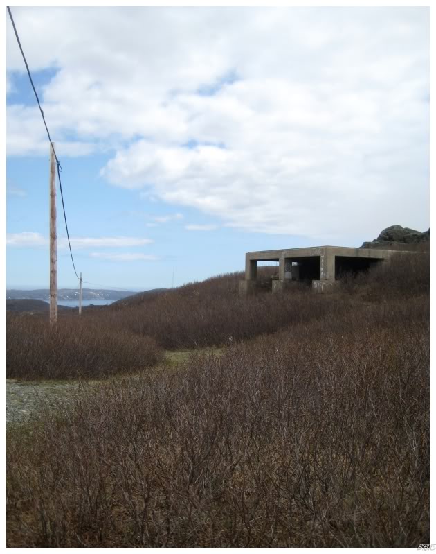
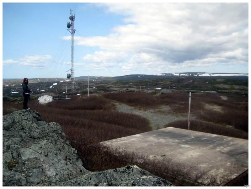
About 2 minutes from the lighthouse lies a road called 'American Way'. American Way is a half mile or kilometre length road from the town of St. Anthony up to the former Pinetree Line radar site that was previously manned by United States Air Force personnel (USAF).
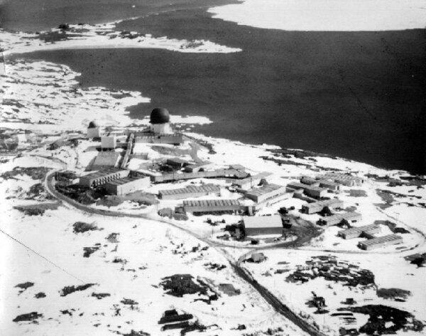
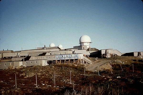
The Pinetree Line was a series of 44 radar stations located within Canada along the U.S. border to protect North America from Soviet attack during the Cold War. The USAF paid for 22 or the 44 stations and manned 28 of the 44 stations.
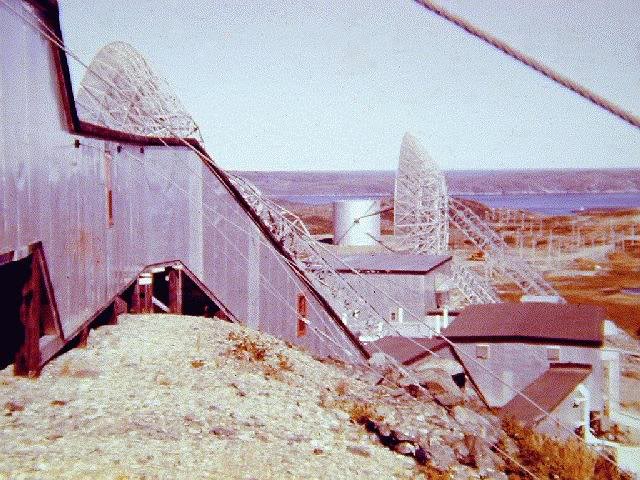
^You can see the cables used to hold down the buildings in this one.
The caption for this photo said that they used to get 130mph/190kph winds; strong enough to blow away the anemometer (wind measuring device).
Construction of the St.Anthony base began in 1951, was operational by 1953 and closed in 1968. Its purpose was to detect any intruders to the northeast quadrant of North America and destroy them if necessary. 150 American soldiers and 13 civilians manned the base where every building was connected by corridors and you never had to go outside.
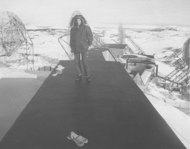
You can understand the necessity of this when you see pictures showing snow as high as the hydro lines and also that they had Plymouth Motor Company build 3 special snowmobiles for travel (http://www.pinetreeline.org/photos/stanth/stant319.jpg)
The technology used in the Pinetree Line stations became outdated very quickly. Many of the locations were very close to city centres and with the Soviets beginning to use more jet technology, the Pinetree Line radar stations wouldn't provide enough time if the Soviets were indeed coming. Another, more northern, set of radar stations named the Mid-Canada Line were built to replace the Pinetree Line.
The replacement wasn't full blown though. Many of the Pinetree Sites were kept active with reduced staff - especially the coastal sites.
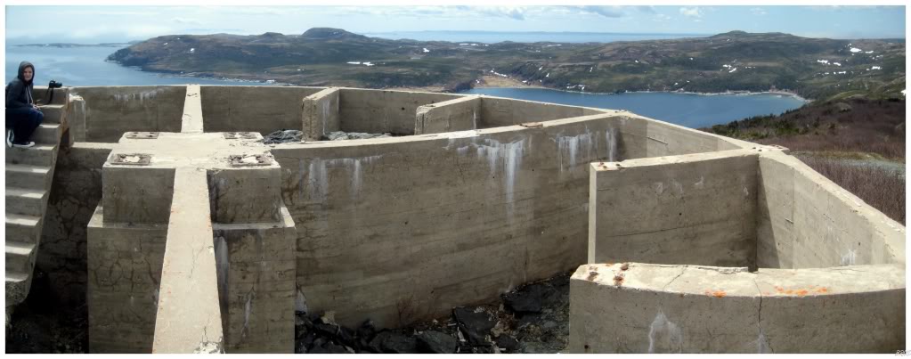
As you can see, not much is left today but some unique foundations.
Still though, interesting history and foundations atop a mountain with these views? I thought it was a worthwhile stop.
One of the funnier things about this location is the fact that it is promoted on the town of St. Anthony website (http://www.town.stanthony.nf.ca/attractions.php); where they tell you to park and walk 30-45 minutes or drive the road if you have 4 wheel drive.
My poor Intrepid man I tell ya - we drove the rough road right up to the foundations and took in our surroundings and the small amount of actual exploration involved with each foundation.
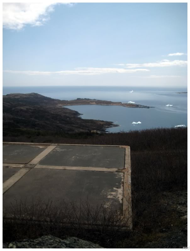
Much like the moose yesterday, once we saw one iceberg, we spotted a bunch.
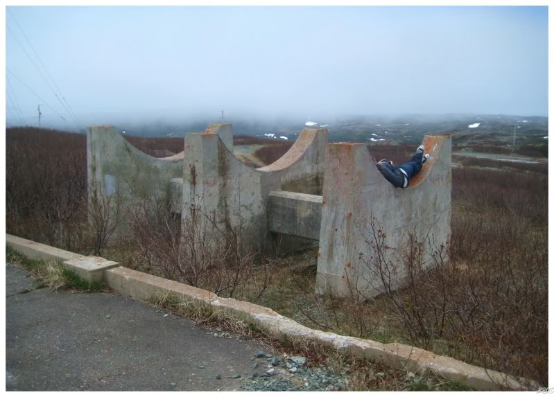
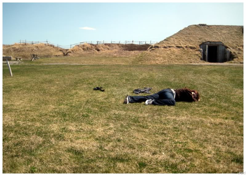
Also, while I had been teaching Kristen about the ways of getting up early and being focused; I was learning hippy tactics like using heating oil tank foundations to relax and absorb air and sunshine.
It was a little chilly, but nothing you couldn't withstand if you were to bundle up and squish your body together for heat.
I think we laid atop our respective heating oil tank crescents for a good 20 minutes...I was being converted to hippydom...
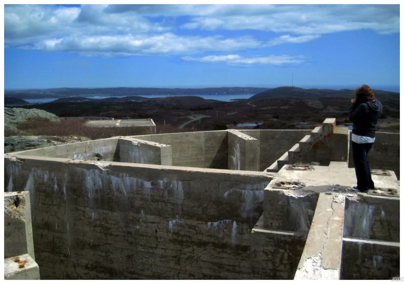
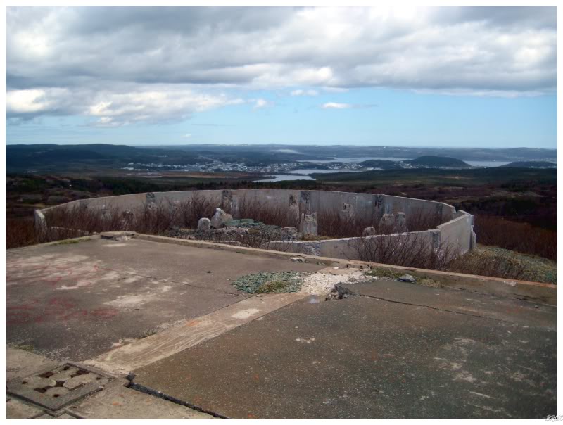
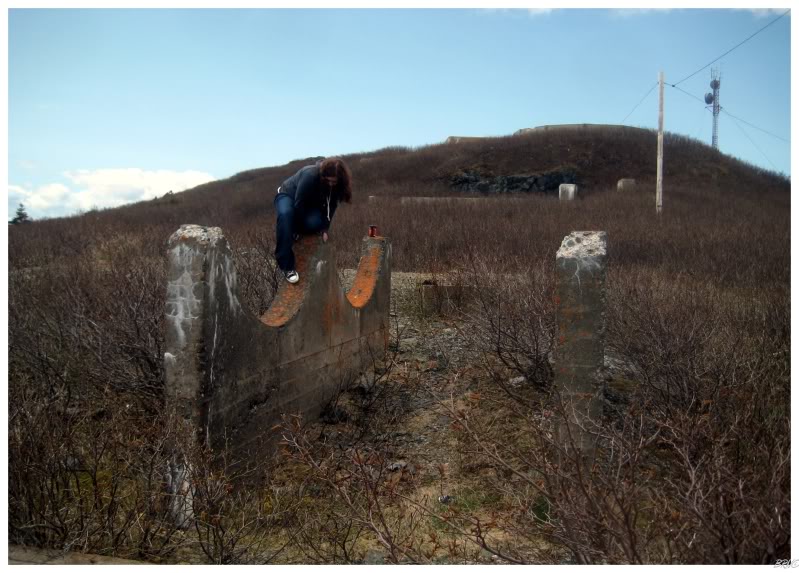
Eventually I grew tired of the heating oil tank foundations and we wandered over to most interesting foundation left at the site - the location of the radome balloon that you saw in the earlier historical images.
Each of the spokes in this foundation wheel where about 10 feet long. Also, the whole thing was 15-25 feet off the ground, so it provided the most fantastic view of our surroundings.
Why there wasn't more graffiti and broken bottles from teenagers was beyond me - I would be hanging out here 24-7 if I lived in St.Anthony (not to say I'd be breaking bottles and painting; I'm just saying that's typical of youth).
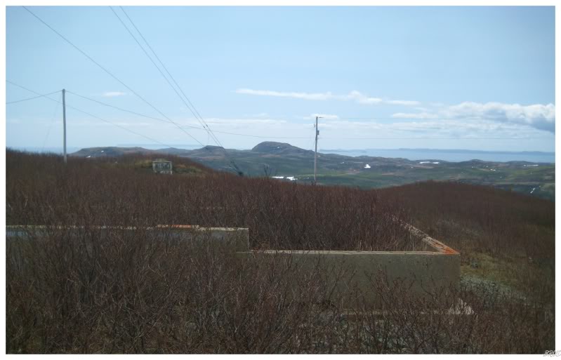
Continuing further from the parked car, the foundations became simple flat rectangles or rectangles with foot high walls - i.e. nothing very exciting. We figured that to be the conclusion of the Pinetree Ruins and we went on our way.
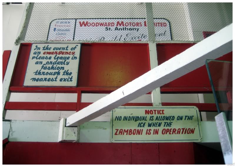
Still in St.Anthony, I abused the fact that I had a girl with me to go into the arena and take pictures without looking like a lonely dork. I believe Kristen was a bit confused but chalked it up to me being Canadian.
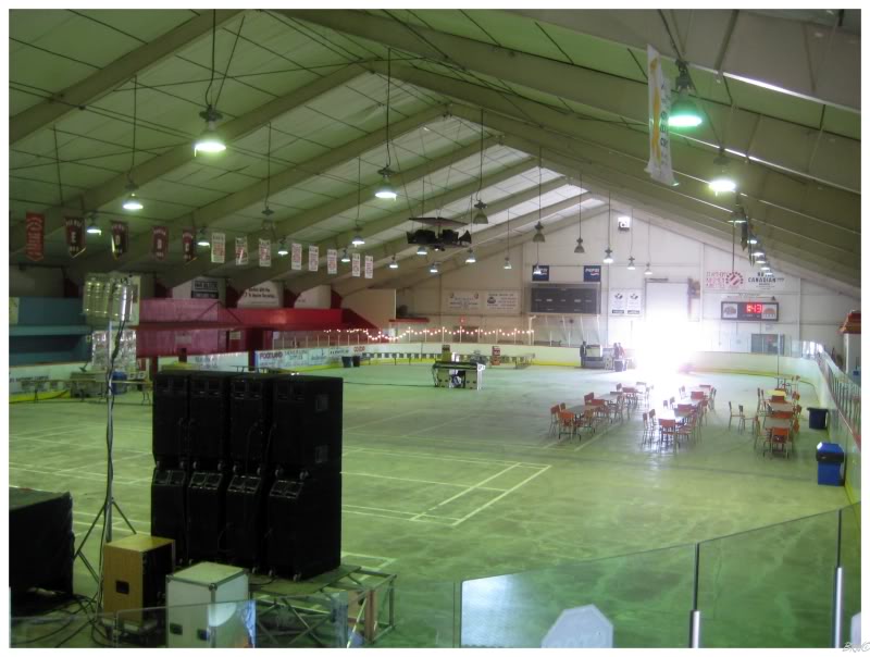
Even if the St. Anthony Olympia wasn't exactly in hockey shape...
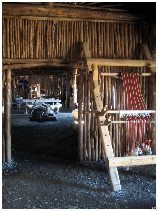
Next up was a half hour drive north to L'Anse Aux Meadows. L'Anse Aux Meadows was the spot where Leif Ericson landed and it is a UNESCO World Heritage Site. I figured I've only seen 3 of UNESCO sites (Canadian Rocky Mountains, the Everglades & L'Anse Aux Meadows), so it would be a worthwhile stop on the tour.
In addition, even if Kristen disliked or didn't care about the spot, it is still really unique terrain and a surreal place in its desolation.
Anyway, I believe we entered the park without walking by the main entrance. There were no tour guides around and we got to show ourselves around the interiors which consisted of recreated chapels, living quarters and viking boats.
This boat was pretty badass, which I stated; but Kristen asked if I'd really want to come from Europe in it.
I suppose that's a good point...
Going outside, the hippy just loved the nice weather and the comfy grass.
"Let's lay here for a while!"
"Are you crazy? I'm not laying on the grass here...lets keep moving!"
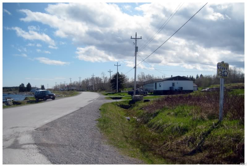
Kristen was unimpressed with my resilience to hippydom, so eventually we did move along and attack that 300mi/400km drive home. There is a highway which is a little out of the way, but brings you to the same point; so we decided to at least switch up the drive home a little bit.
Driving on the new 100mi/160km length highway, there is a total of ONE town. I needed to use the facilities, so I walked into the general store and found the owner standing there with 4 other people all conversing and now turning their attention to the outsider (me). I asked if there were any bathrooms and was told that there wasn't.
After looking around for a bit and noticing that the whole store was on a slant from the dilapidated structure (I really doubt the building inspectors are thorough with Main Brook, NL inspections), Kristen & I went back outside & agreed that this place was weird...hitting the highway and never looking back.
There are definitely some isolated places up in Northern Newfoundland.
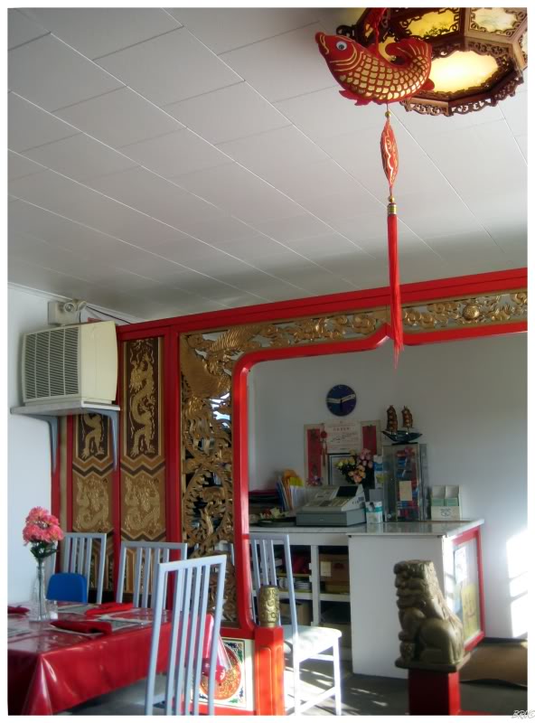
Halfway home, we were ready for some dinner and stopped at some Chinese joint in Port Aux Choix. The food was alright and the service was good...my only complaint being the locals who were loud as 25 simultaneous vacuums.
This thing was though, Kristen and I both realized that these ignorant kids probably eat there all the time versus us who'll probably never go there again - so it's not as if the owner is going to scold them for our benefit.
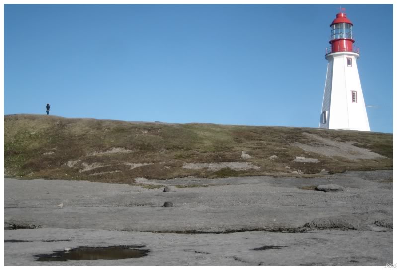
The other reason we drove off the highway to Port Aux Choix was to check out another lighthouse. The drive from Corner Brook to the top of the Northern Peninsula is pretty empty, so even though we had already seen a good collection of lighthouses, I was trying to break up the long drive with whatever I could.
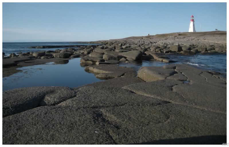
We wandered out onto all of the flat rocks extending out into the ocean as the sun was setting and the waves were crashing.
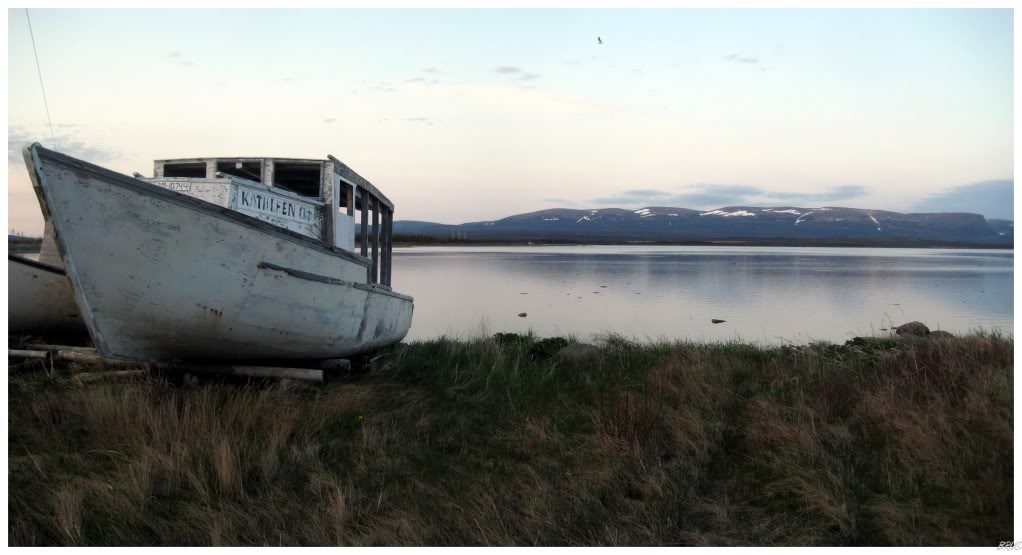
After one last stop at some boats Kristen wanted to photograph, we finished off the drive and relaxed with some playoff hockey and adult beverages.
I've covered this drive in one very long day; but for reasonable people, this was a great start to the trip and a fair chunk of the province seen.
Navi
Onto Day Number Four
Sources:
1 - Snowmobile Photo - Pinetree Line Website, Original Source: Thomas (Ron) Biggers
3 - Pinetree Line - Wikipedia the Free Encyclopedia
4 - Wind Wires Photo - Pinetree Line Website, Original Source: Larry David
5 - Man Atop Building Photo - Pinetree Line Website, Original Source: Thomas (Ron) Biggers
6 - Town of St. Anthony - Premier Tourist Destination - Attractions
7 - Aerial B&W Photo - Pinetree Line Website, Original Source: Wallace Rose