Just like every other time I've headed down to Louisiana, I checked The Lighthouse Directory to see what lighthouse visits were possible. Knowing about the endangered lighthouses of the Mississippi River Delta and offshore of Louisiana, I even considered taking a Louisiana boat tour, something I wouldn't usually consider because it doesn't allow me to "stand before" any of the lighthouses and count them in my own silly way. I didn't actually have to weigh this decision as I soon came across interior pictures of the South Pass Lighthouse, where a local tour company somehow got out of the boat and climbed the skeletal-style tower. This was the tour we were going to take. |
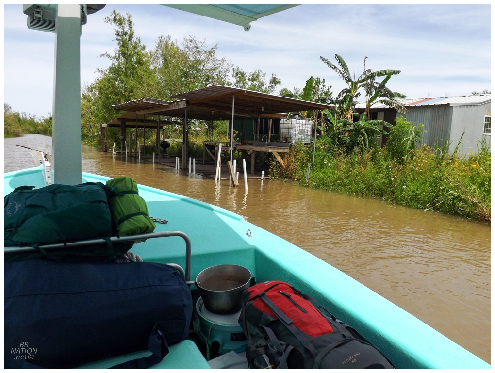
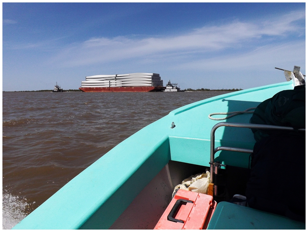
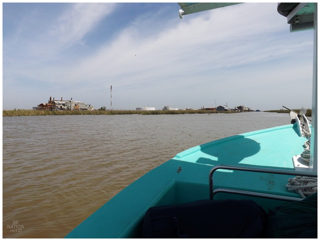
Coming from Mississippi, we kept to the east of New Orleans and then had an hour's drive to get to the last community accessible by car in Louisiana (Venice, Louisiana). I absolutely loved this drive south of New Orleans, thanks to my love of True Detective Season 1 and boy was I ecstatic when we stopped for some beer and the liquor mart was rundown and musty. It could have fit right in as somewhere Marty & Rust also stopped. Down in Venice, we rushed to get our bags ready for the boat and Isy was filled with questions I couldn't answer. The tour boat operator wasn't the best at answering his emails - he later admitted he needed an administrative assistant - so I was just going off the scant information I had while we tried to be ready for anything. Heck, Richie hadn't even fully confirmed our time to meetup here at Venice Marina, so I was sort of hoping and praying that the time we suggested a couple weeks ago was agreed upon and not just a possibility. We got there a bit early and that made us sweat as we wondered if this was going through, but Richie appeared with a guy named Shep and we were whisked off towards our vessel. Before long, we had left behind the Venice Marina and its large fishing trawlers, cabins and lifted trucks. I thought we might be right out into the mighty Mississippi in short order, but we stopped comically close to the marina to exit the bayou we were travelling and poke into a narrow creek. |
There wasn't one of those "meet your captain" pages on Richie's website, so all I had to size him up was two or three brief phone conversations. As we pulled into this area and Richie pointed out plants and birds with their proper name, I grew even more excited about this trip. His love for the area and its flora and fauna was infectious. |
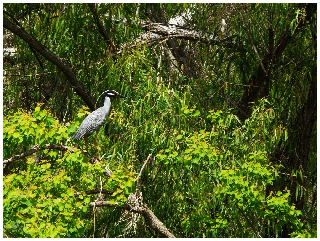
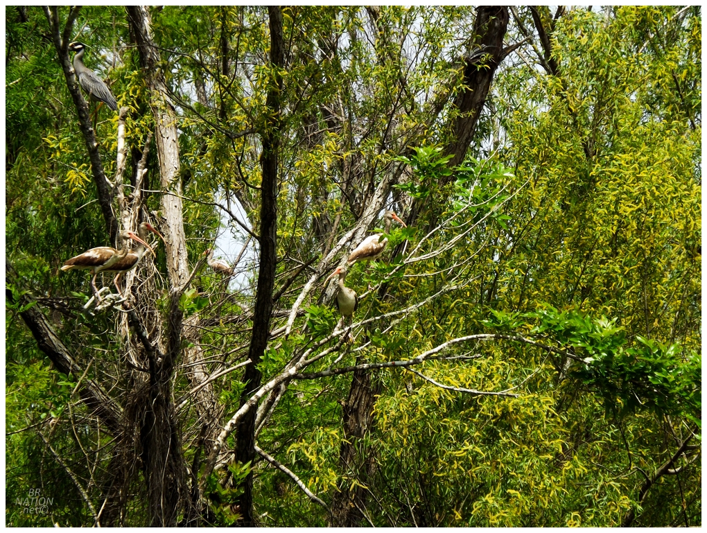
At the time I was slightly bummed because I thought this was a Black-crowned Night Heron - a bird which I've already seen in Denver - but it's actually a Yellow-crowned Night Heron, a new lifer! |
Isy was much more excited about the possibility of seeing alligators than night herons, but every time Richie pointed one out, the gator would've already slipped below the water line and away from our prying eyes. It was also around here that we saw a big ol' speedboat racing down the channel, captained by a guy that looked Sam Elliott in Road House, along with two woman hanging on and wooing beside him. Richie explained that it was some other tour, and that he and that guy work together to steer people towards the right tour guide based on what it sounds like the person wants. Isy and I were both already taking a liking to Richie and enjoying our tour, but neither of us could deny that the other tour also looked like a lot of fun, haha. |
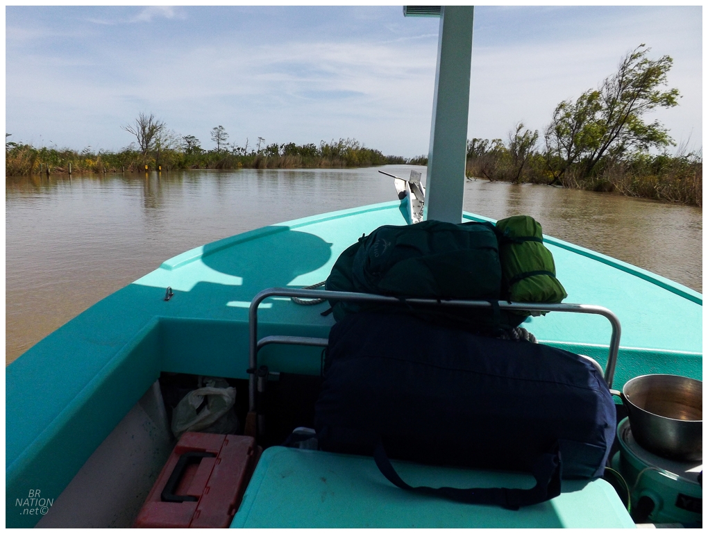
Okay, now we're getting out of the backwaters! |
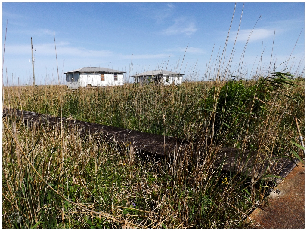
Heading up the east side of the Mississippi, we soon came to the village of Pilottown. Pilottown became a community after the downriver village of La Balize was abandoned following the great hurricanes of 1860. Pilottown's main function was to provide housing for the men who would board ships that were entering the Mississippi and heading up towards New Orleans or Baton Rouge (these men are known as river pilots). It was still inhabited right up until Hurricane Katrina, but an almost direct hit from Katrina caused heavy damage to almost every building, including knocking the 100-year-old pilots building off its piers. Today there's still a pilots building, oil tanks and docking facilities at Pilottown, but pilots only stay temporarily while working shifts. A couple of old homes sat abandoned just off of the concrete walkway and Isy knew how much it killed me not to explore something so obscure. |
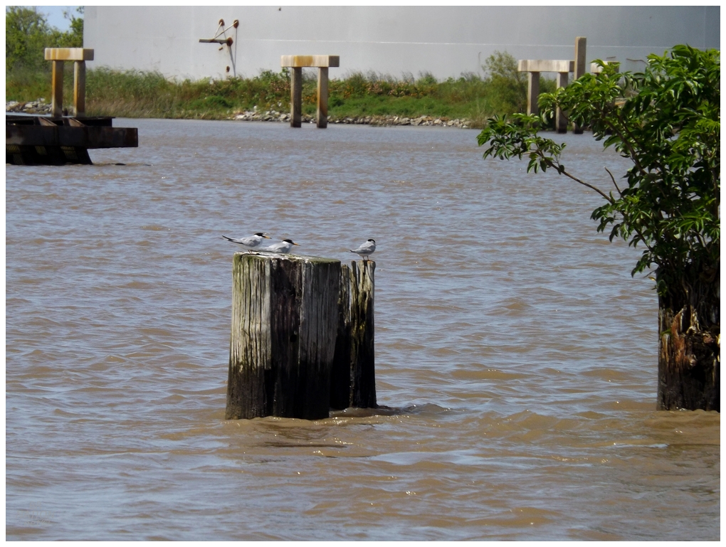
Royal terns hang out on a pier at Pilottown. Another lifer. |
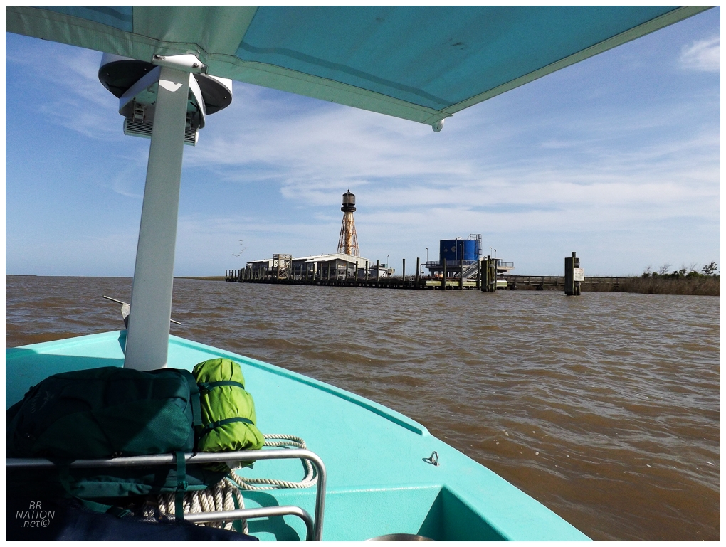
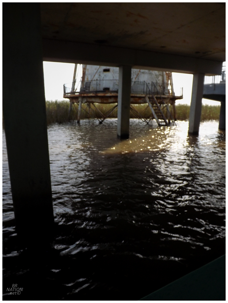
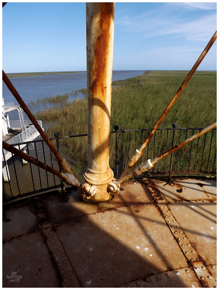
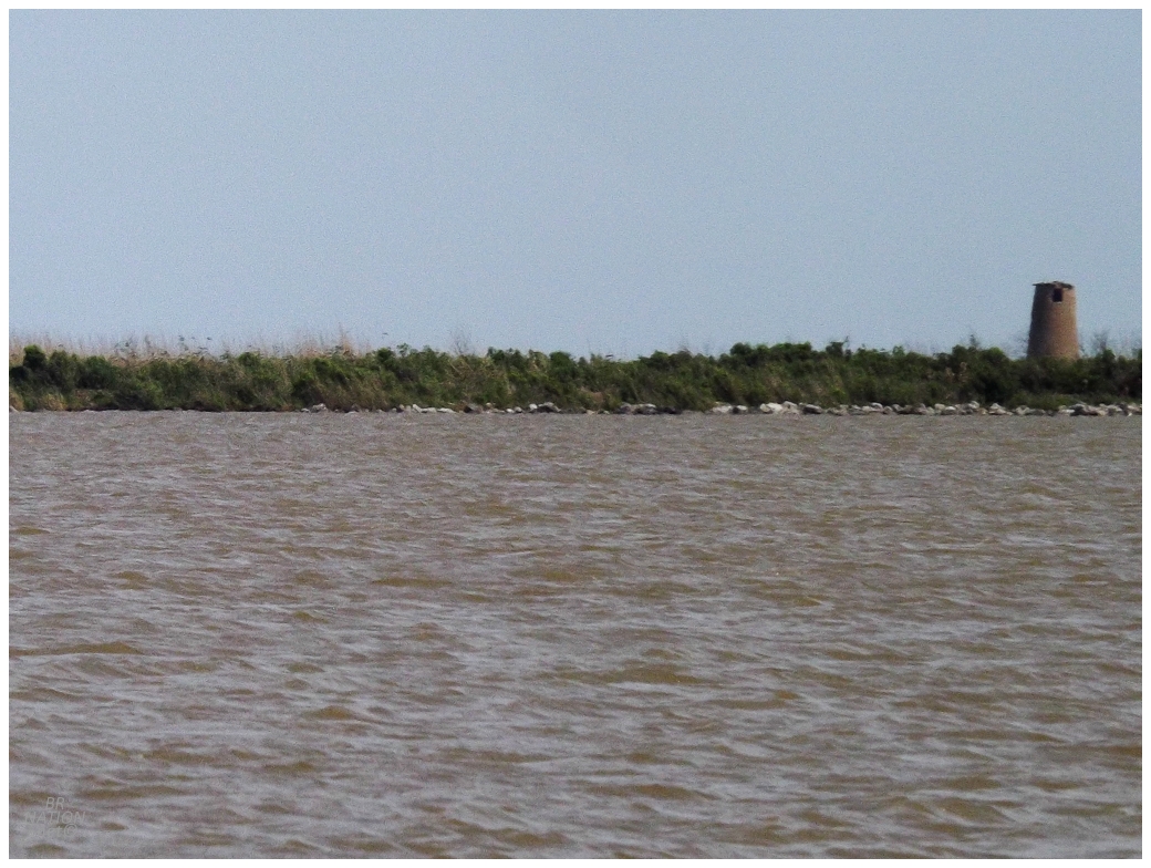
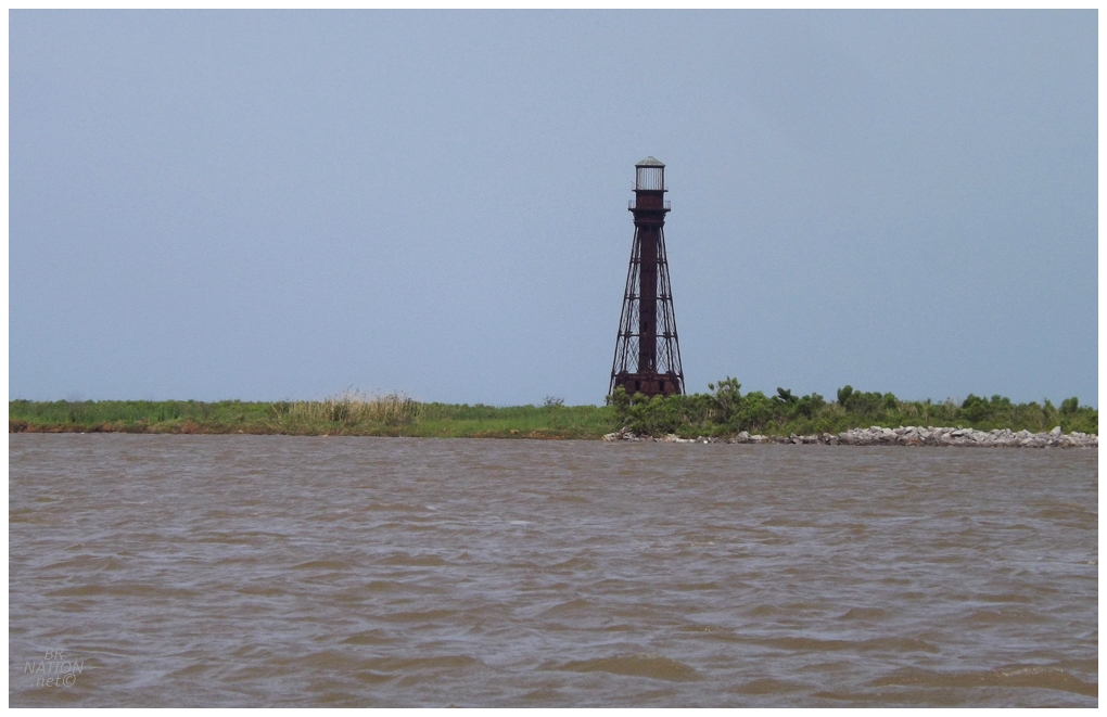
From Pilottown, I was happy to head another 20km (12.4mi) south, and now a total of 35km (21.7mi) south of Venice, to reach the ultimate destination of this whole journey: the South Pass (Port Eads) Range Rear Lighthouse, built in 1881. With only 3km (2mi) more until the open Gulf of Mexico, I found it pretty crazy how far out we were. |
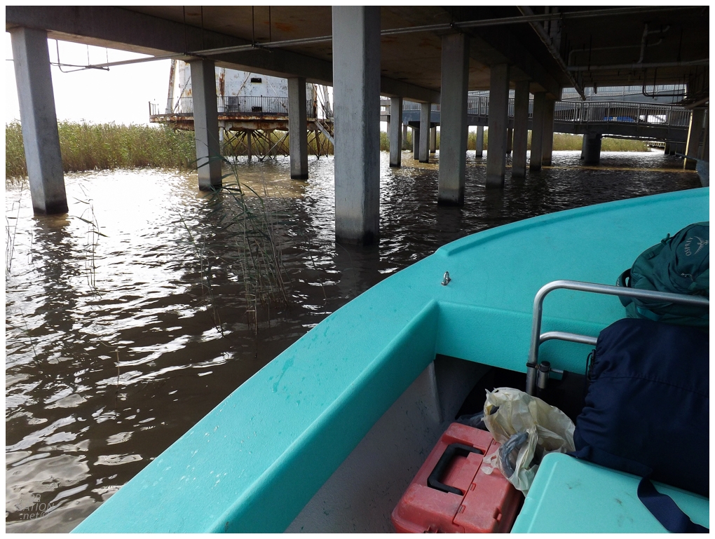
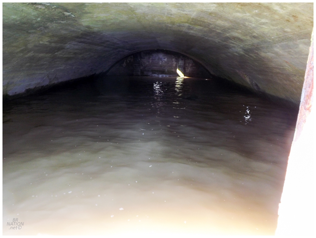
The whole marina here is abandoned and was said to have a security guard, which always killed any hope of climbing this lighthouse for me. I brought this up to Richie and he scoffed and told me he didn't know about all of that - leading me to think we were just going to tie off to the marina's dock and climb on up - but no, it was time to pick our way underneath! |
It was around this time that I discovered my camera had an occasional problem with focusing. What timing. |
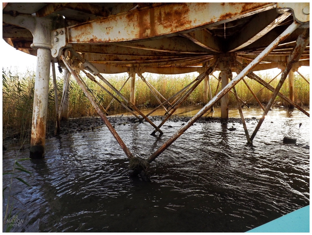
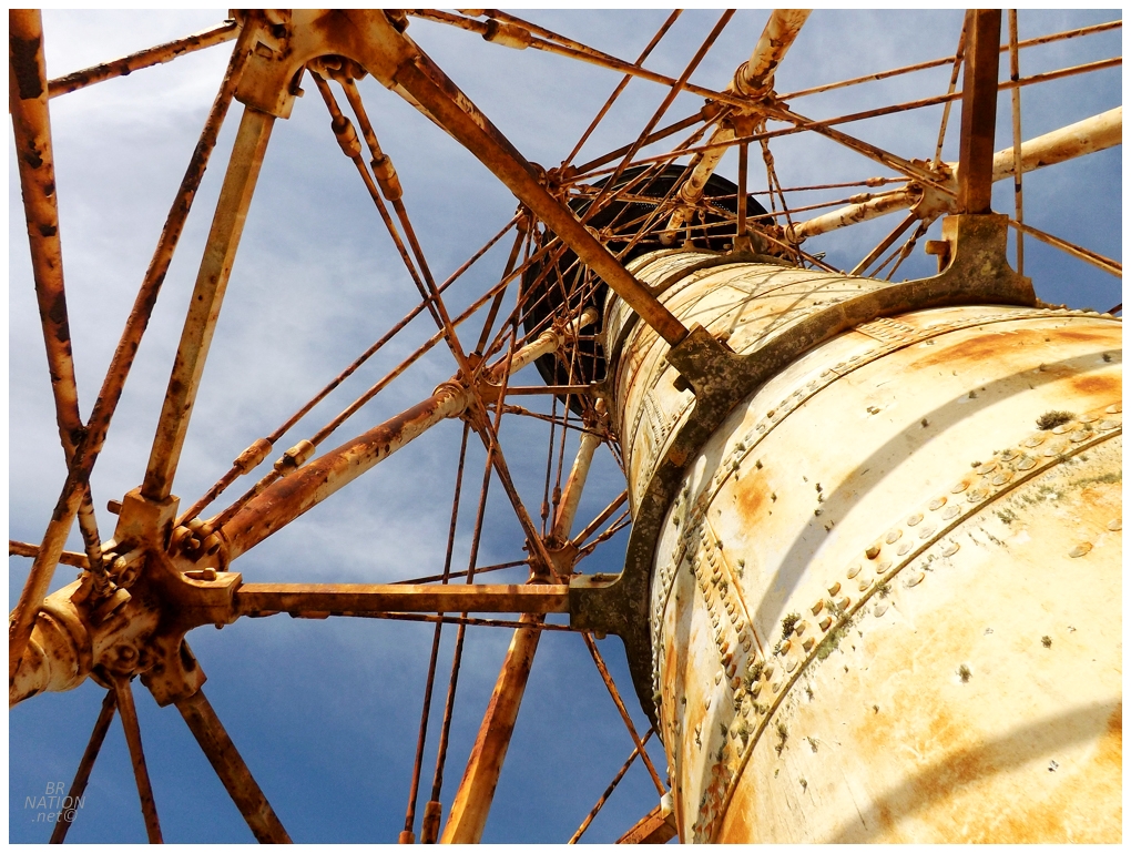
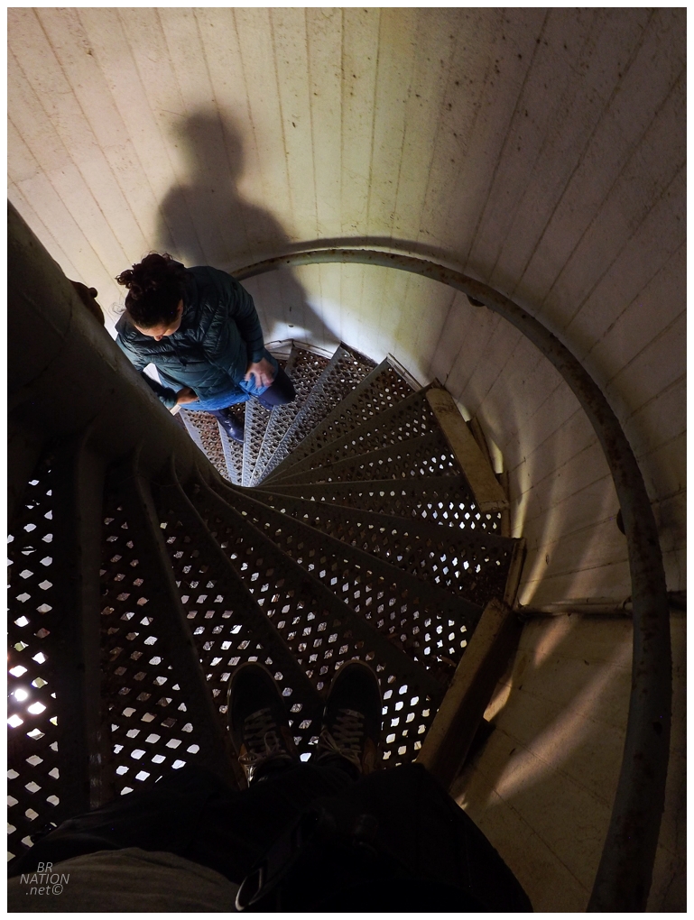
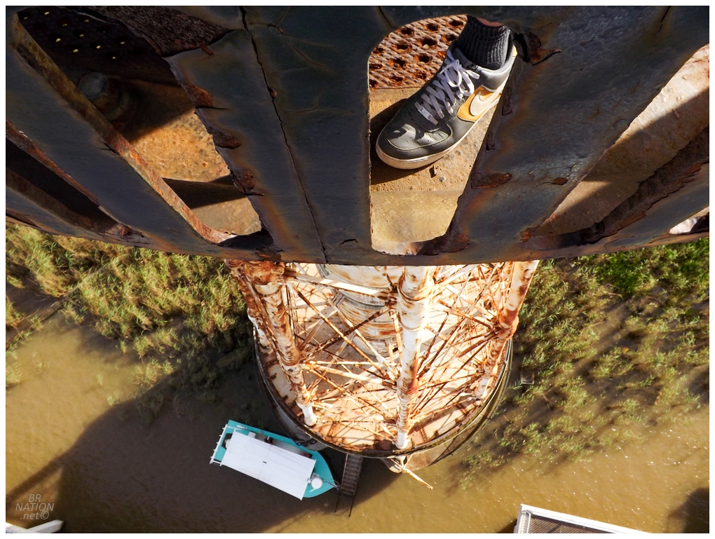
I happily volunteered to be second off the boat (of course I'd let Shep go first and clear the way of any snakes or spiders, lol). Isy was next and then Richie. I couldn't believe we had made it as we stood here at the base of South Pass Lighthouse. This was enough for me, but the rest of the group thought it was a bit silly to dock and climb over a handrail just to skip out on climbing up to the lantern room. I guess they had a point! |
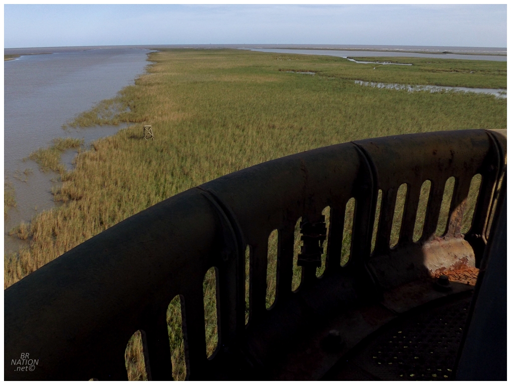
The Head of Passes is the point of the Mississippi River where the river finally splits into the three branches of its bird's foot delta. The branches include the main Southwest Pass, Pass A Loutre (east) and the South Pass, which we boated down and is shown above, looking out towards the Gulf of Mexico. |
In 1829, Congress approved $40,000 for lighthouses to be constructed at Southwest Pass and South Pass, the two main entrances to the Mississippi River at the time. The first South Pass Lighthouse and a keeper's house was constructed in 1831 on Gordon's Island. This keeper's house was knocked off its foundation by downriver logs in 1841, while the lighthouse was destroyed by a storm the next year. They decided to build the next lighthouse across the river, but it was built of wood and suffered from rotting within five years. A third tower was built in 1848, a strange, wooden structure with a southern-style, covered front porch and an octagonal lighthouse sticking out of the centre of the roof. |
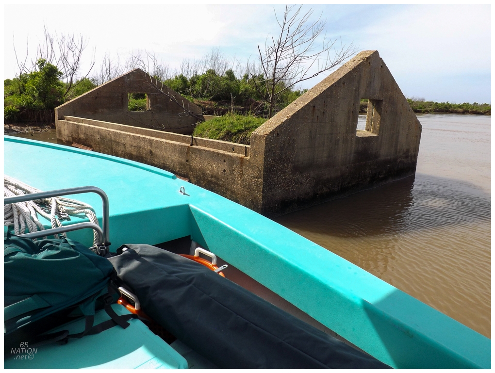
By 1867, the 1848 wooden structure had deteriorated to the point that the Lighthouse Board petitioned Congress for enough money for a first-class lighthouse, as this was a lighthouse that guided ships coming from both Europe and the Caribbean. The call for a new lighthouse grew in 1876, when James Buchanan Eads built wooden jetties along both the Southwest Pass and South Pass; these jetties fighting back and preventing the ever-present silting that hampered shipping in the area. The jetties worked so well that New Orleans shipping doubled and Eads was rewarded by having the small village here at South Pass named Port Eads in his honour. Congress finally approved $50,000 for the construction of a new South Pass lighthouse in 1879. The new lighthouse was built 100 feet southeast of the third lighthouse, at a height of 105 feet and equipped with a first-order Fresnel lens (this lens is now located at the Louisiana State Museum in Baton Rouge). |
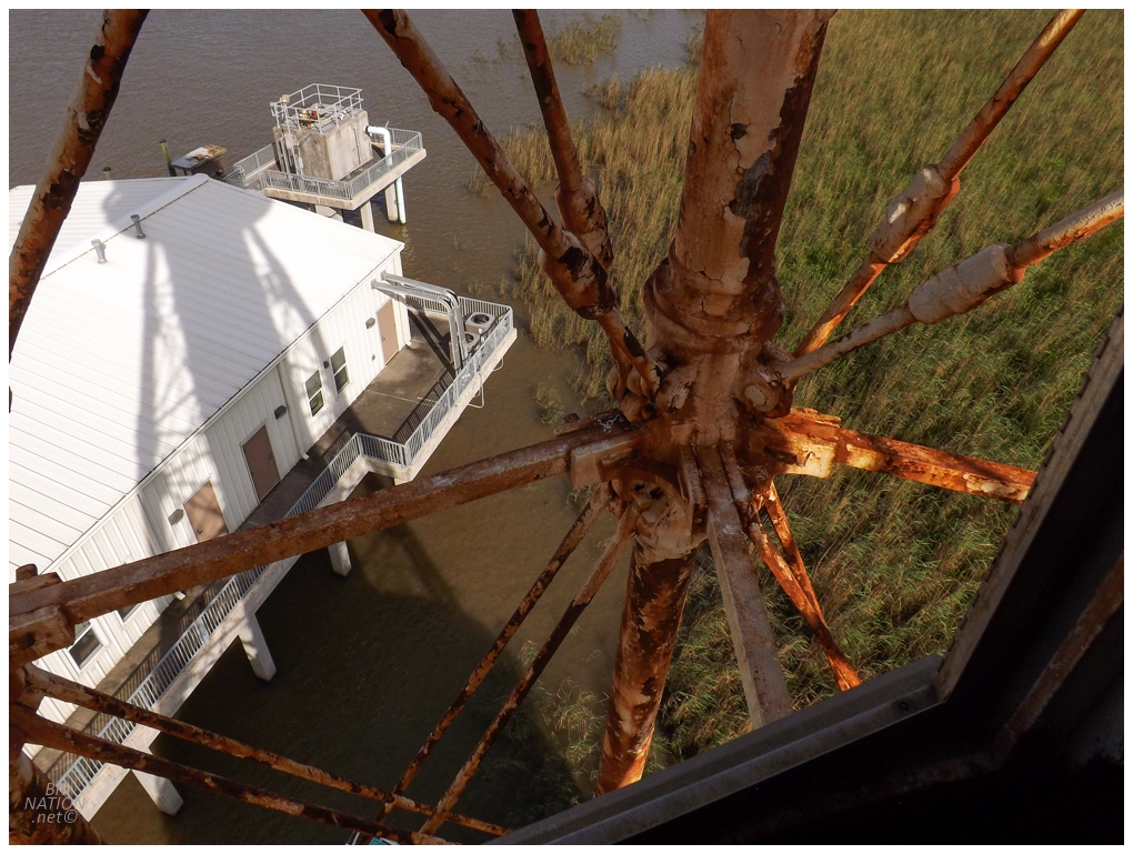
The South Pass Lighthouse was the only building at Port Eads to survive Hurricane Katrina. As part of FEMA funding, the state was given $12 million for the construction of a new marina here, which is the white building you see below. Richie said it was a total waste of money and it closed a couple of years ago. I wondered about exploring the buildings, but it appeared more vacant than abandoned. (Plus, if I climbed down from a remote, abandoned 1881 lighthouse to explore bunkhouses constructed in 2013, I'm pretty sure you guys would have me committed.) |
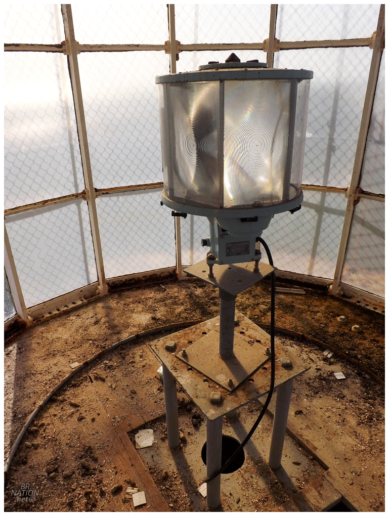
I was also busy taking a thousand pictures and savouring this whole experience, since this lighthouse was abandoned in 2014 and is now clearly endangered. And while it survived Katrina, lighthouses of this stature have disappeared in hurricanes before, which is both terrifying and fascinating. |
There's a solid argument to be made that this was a top 10 day in my life. Good God was this sweet. |
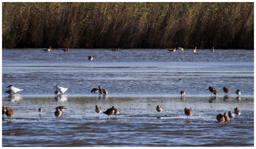
We went for a spin out to the open sea at the Gulf of Mexico and then made a return pass past South Pass Lighthouse. Motoring on to our next destination, there were occasional bars where shorebirds fed in the shallows. One of the cooler birds was the American Avocet, but unfortunately I have one of the rare observations of an avocet in Newfoundland, so it's not a lifer for me. |
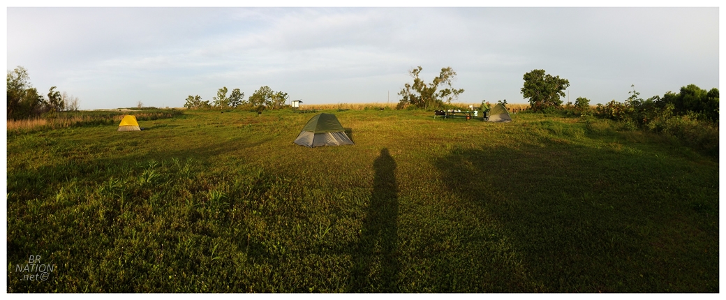
Another factor in considering this as a top 10 day was that we were going to camp out here. Yes, out here, only 25km (15mi) from the southern tip of Louisiana, far away from any roads or communities and off on some obscure parcel of land. Richie gave us the option of simply pulling up on a random beach and making camp, or the option of using one of the tent-only campsites at the Pass A Loutre State Wildlife Management Area. I liked the idea of a unique campground much more than some random beach, so pushing for the campground option, Richie scouted a little bit and then decided on the Fresh Water Reservoir Campsite, located about 10km (6mi) north of South Pass Lighthouse and 25km (15mi) south of Venice. Pulling out all of the tents and cooking gear, Richie said we just needed to build our tent and then we could head off to explore while he heated up some jambalaya he prepared for the trip. And oh yeah, if we were thirsty he grabbed a cooler of random beers from his fridge. This man knew how to plan a day! |
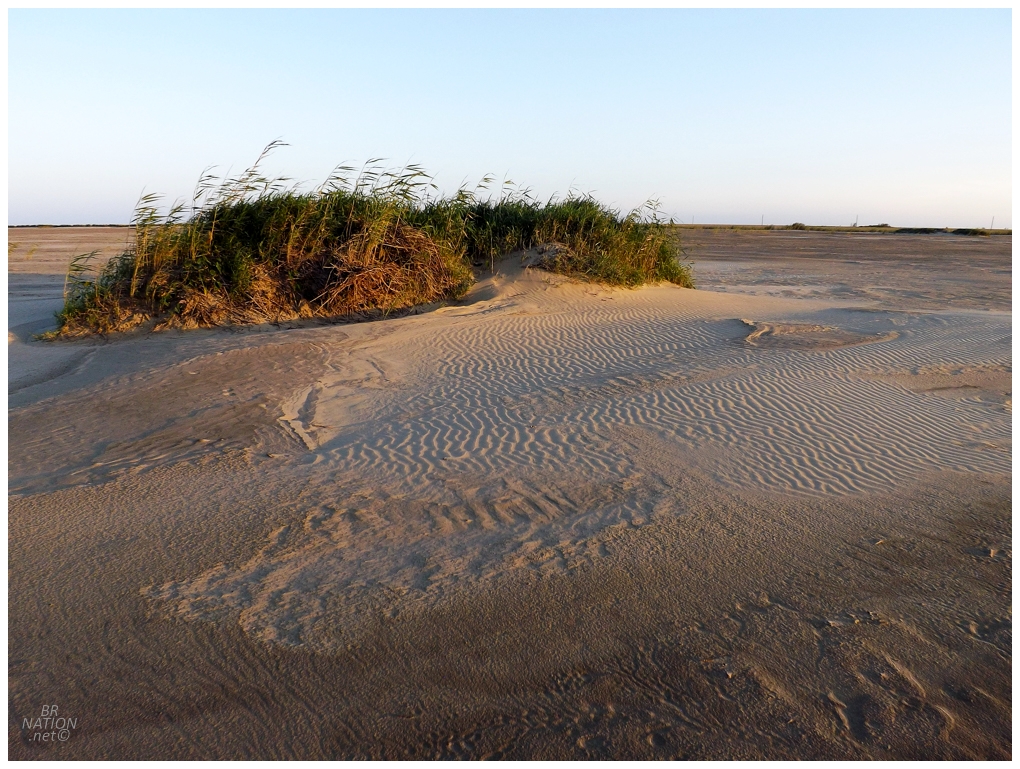
You might be questioning where we could hike if I wasn't willing to dive into any of the grasses or get too near the shoreline for fear of alligators or snakes. Richie mostly chose this campsite though, because there was a huge area for hiking made up of dredged sand, aka dredge spoils, that stretched out for a kilometer to both the south and the east. Isy and I enjoyed the deafening silence out here as the sun lazily dipped towards the horizon. She would get up for sunrise and repeat the exercise and I remain jealous that I didn't think of doing the same. |
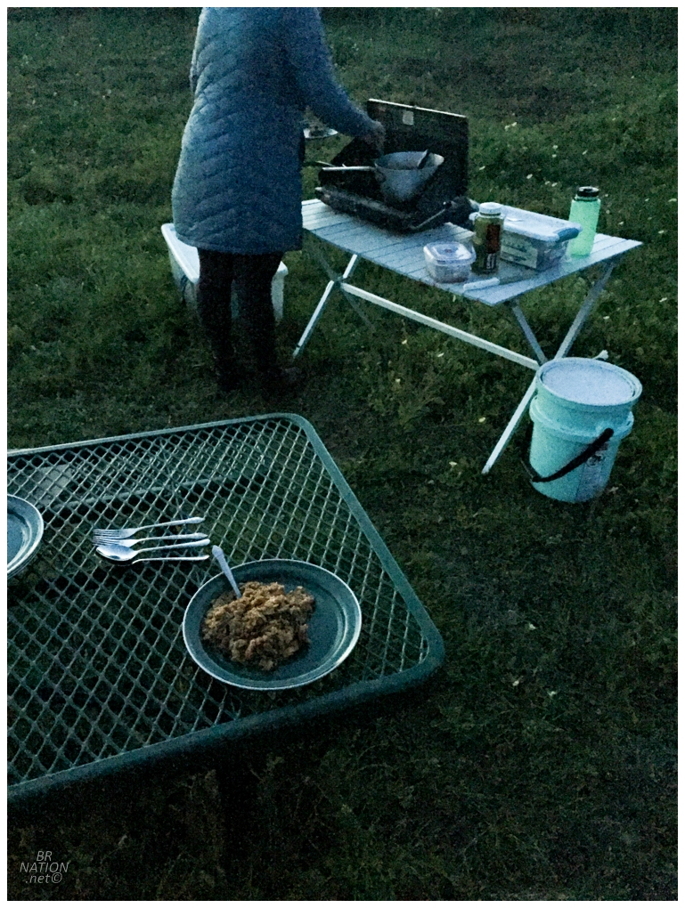
Jambalaya is in a category with chili cheese burritos, intense pickle Doritos, salmon/rice/salsa & Windsor pizza, of food that makes life worth living. This was very good jambalaya too and I found it hard not to pig out. After dinner we sat around for another beer or two, before a full day out in the boat and in the sun, made all of us peel off for our respective tents. I was last to go and as I unzipped the tent door with Isy inside, I didn't like the look of this spider at the top of the door, but she was hollering at me to hurry up so I wouldn't let any mosquitoes in. Annoyed at being rushed while having to deal with a sketchy spider, I gave him a little whoosh with the hand as I tumbled into the tent, hoping that the creepy spider hadn't joined us. Neither of us woke up with a gnarly spider bite, so I guess all's well that ends well. |
The next day we pulled up to the house of a man who lives out here and keeps cows out in the swamp. I was a bit annoyed with Richie bringing Isy around a shirtless, ripped, tanned man with a tasteful hint of Louisiana twang to his words1, but I did appreciate that we were able to use his washroom, haha. |
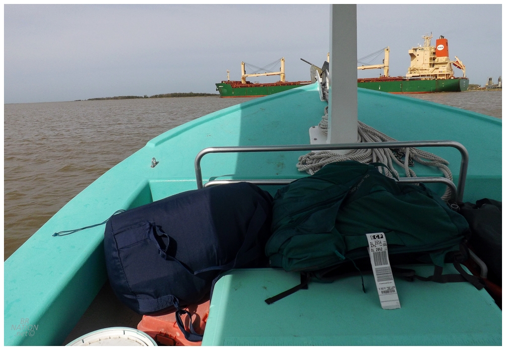
Back in the main part of the Mississippi River, Shep knew the captain of a giant ship that happened to be going by, so after placing a call, we were able to motor alongside this giant freighter and wave to each other. |
Richie asked what we wanted to get up to today and I obviously wanted to see more lighthouses, but I also didn't want to turn this into my personal lighthouse tour. My decision was helped along by spotting the 1839 Southwest Pass Lighthouse, but Richie stating that he'd been over there and how "the juice isn't really worth the squeeze" when it came to wading through the marsh for half a mile just to get to a ruined tower. I didn't want to argue with him and truth be told, I wasn't sure if I wanted to wade through marsh down here. |
We also passed the 1871 Southwest Pass Lighthouse and it also stands in the middle of marsh that you would need to trudge through. Instead we kept it moving and checked out some other stuff. |
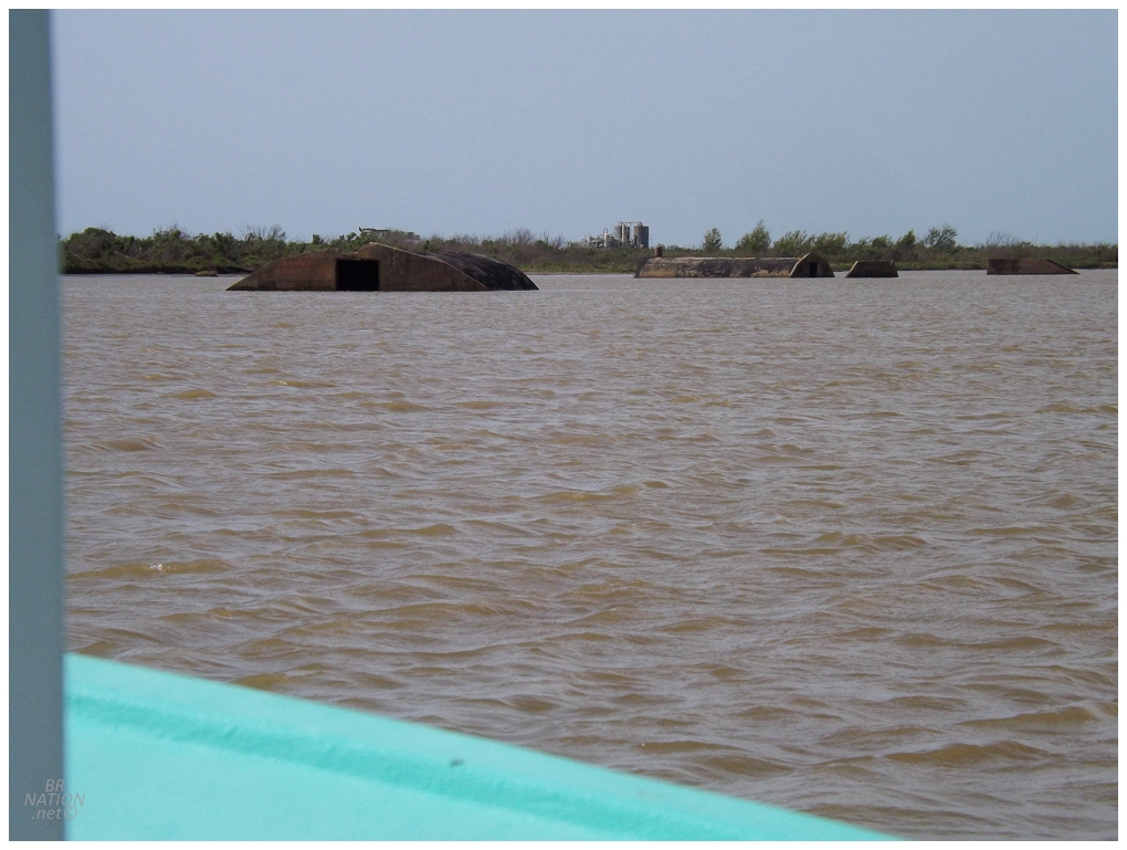
One of those things was right across from the Southwest Pass Lighthouses: the coastal defense installation known as Battery 155 - Burrwood. The community of Burrwood was located nearby and once had a population of 1000, but these structures are from the naval base established in 1942, to monitor if any German subs were going up the Mississippi to attack ships or New Orleans itself. Over 20 buildings were moved (pre-fab) or constructed here, including nine 48-foot by 16-foot huts, a 20-foot by 76-foot supply building, rec hall, mess hall, and lavatory building. By 1944, the German U-boat threat had subsided and the guns here were shipped to other forts. The village of Burrwood would continue on as a home for fishermen and a weather station/hurricane warning station; but the weather station was closed in 1965. Today, nothing of the actual community of Burrwood still stands. |
There's a couple of extensive websites about North American Forts and regarding Burrwood, one of them says "Current status: no remains" while the other one says "It is not likely that any trace remains due to severe erosion of the area." Which is pretty neat, because here I was exploring something that those exhaustive fort historians didn't even know still existed. Although, when you look at satellite imagery of the area, these structures are now entirely hemmed in by dredge spoil - so maybe they appear and disappear semi-regularly? |
Now this is exploring! |
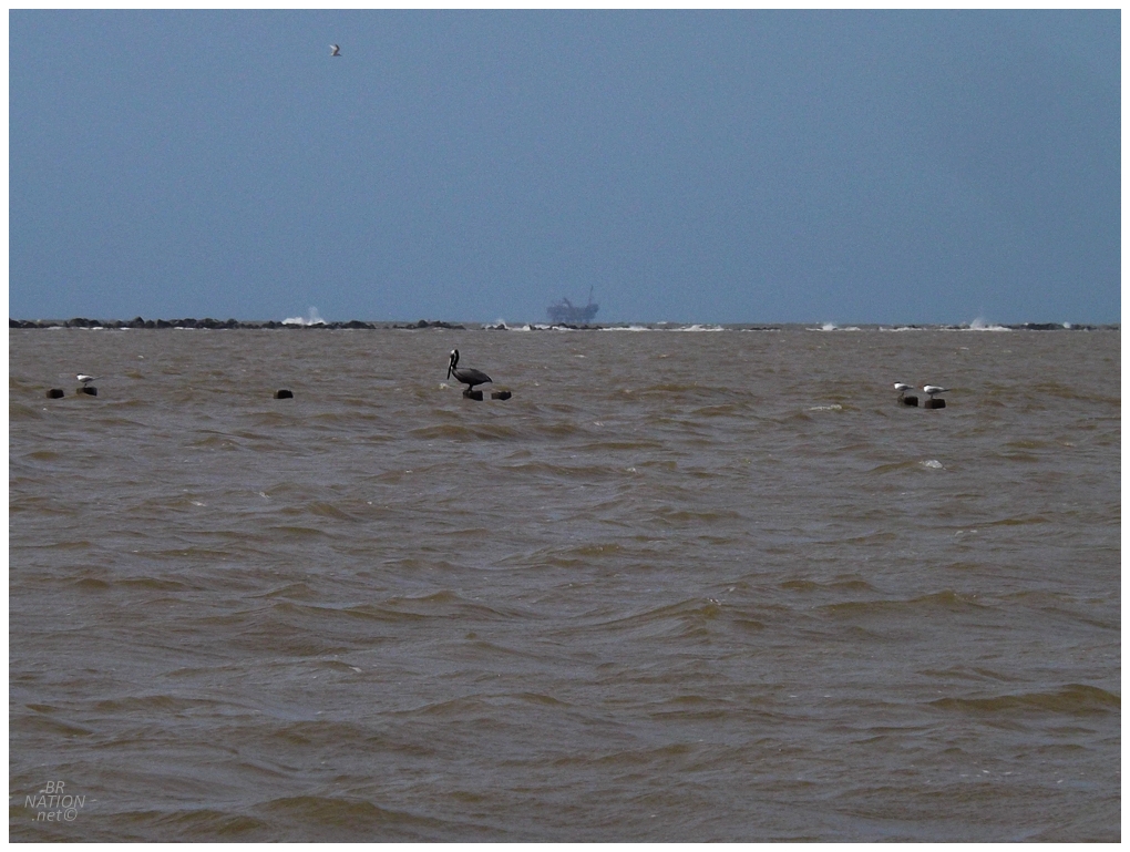
Since we were once again so close to the Gulf of Mexico, we went another 5km (3mi) down the shore in order to check out the scene near the Southernmost Point of Louisiana. I have this memory from when I was 7 or 8, of swimming in the calm, pleasant Gulf of Mexico and this trip changed my impression quite a bit. She can get quite angry my friend! |
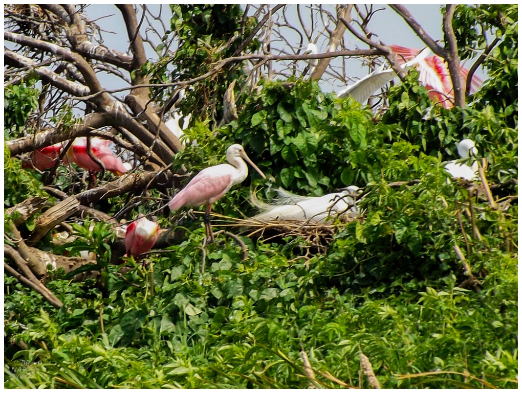
We were now about 50km (30mi) from the marina back in Venice and it was time to start heading back to some degree. Along the way, we pulled into some bayous and quieter channels, stopping to do more birding. |
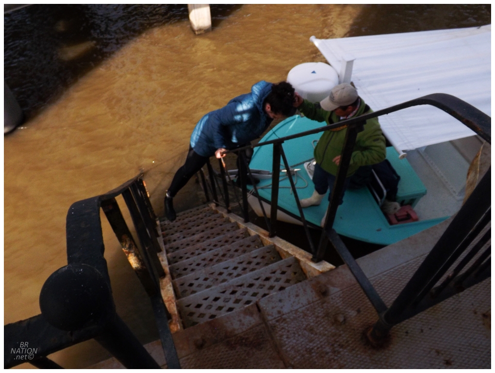
We also passed lot of worn out oil facilities, where it wasn't easy to tell if the whole thing was abandoned or not. Anyway, landing back at Venice Marina, I couldn't thank Richie enough. It may have been a bit annoying with the lack of communication, but both Isy and I were ecstatic with our decision to take our chances and hope it would all work out. This was so much better than just a short pop out to South Pass Light and I dream of having another opportunity to tour with Delta Discovery Tours. (Especially as I'd love to see the Pass à l'Outre Light if I happened to be here when it occasionally has a sandbar.) |
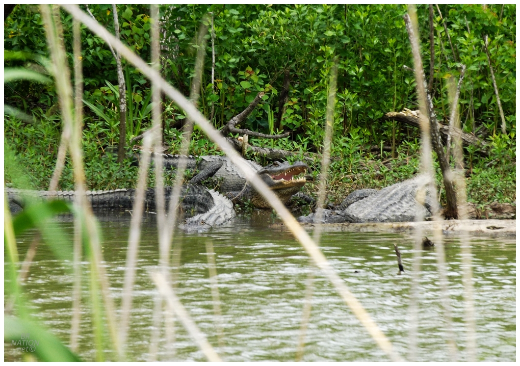
Leaving the marina, we could see Richie & Shep stopped up ahead and the two of them pointing to the side of the road. Worried they may be having car problems and scooting over to the side of the road behind them, they instead hollered at us that Isy's sought-after alligators were down in the ditch. There wasn't just one either, there was a whole bunch of them! A congregation of alligators! Isy was pleased. |
