Broad Cove Point (Route)
Spring 2010.
Some of you might remember me briefly mentioning a lighthouse in a past update about the PineTree site near Stephenville; if you don't, the gist of it was that I was in the neighbourhood and contemplated an 8km(5mi) lighthouse hike, but decided to leave it for another day.
Well I was sitting at work and got it in my mind to get this lighthouse hike done. I was forced to wait until it was warmer, but by mid-May, it was warm enough & I was on my way.
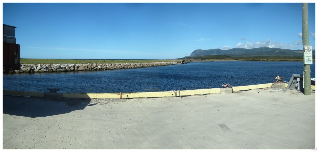
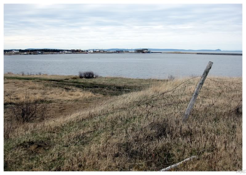
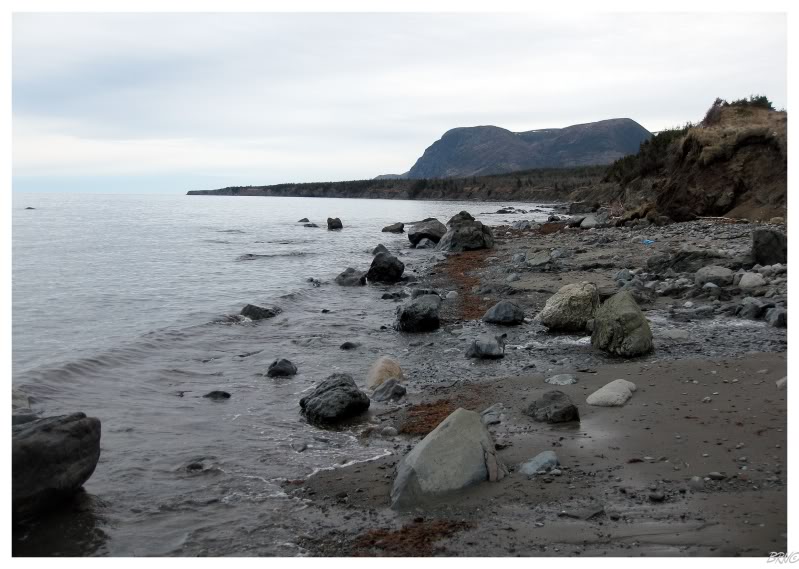
Two lighthouses stood 8km(5mi) from where I took the above picture, near the base of the mountain you see near centre.
One reason I had to wait until May was because this hike required fording of the Fox Island River. If you look at the topo map, the Fox Island River at the bottom isn't very thick, so I figured that we should be able to walk upstream and eventually cross somewhere shallow.
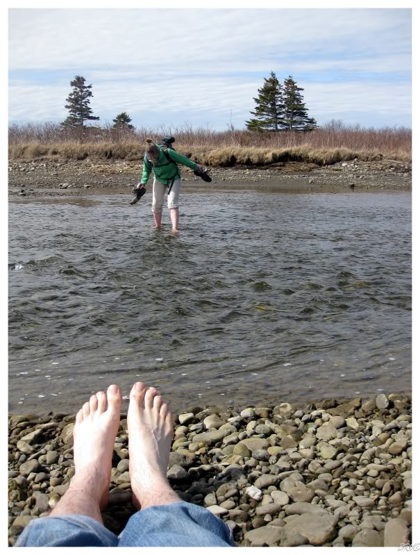
Walking across the first portion to the first island is shown in the above picture. The water never reached past my knees, but nonetheless, the combination of the slippery & jagged rocks + the frigid water was hell on my feet. When I did reach the island, I fell to my backside and rubbed my feet, cursing how much the Fox Island River hurt.
I'm still not sure why I thought a river fed by Newfoundland's highest peak would be warm enough in May...
I was also surprised how well Nicole handled the crossing. Where my feet felt like they were being whacked by a two by four of nails, she wasn't having any serious problems...
Sure enough the next portion would be much tougher (as shown above).
I typically navigate, so when I found deep water where we planned to cross, I pointed us southeast, going further up Fox Island River. That wouldn't pay off & we would actually reach deeper water and thicker forest.
We returned to the original deep portion and decided to give it a try. It wasn't deep enough to require swimming, but it was also deeper than the knee's height.
Thankfully, the community of Fox Island River was now far enough away that I could casually take my pants off as it was clearly required. Holding my pants above my head with one hand and my camera in the other, I slowly eased into the water with the same frigid temps and the same jagged rocks - this time though, it was going higher and higher, moving past my calves, past my knees and up onto the thighs.
Thankfully, the ground below me leveled as my upper thighs started to catch some of that water. I was worried for a second and switched all of my possessions to one hand, so the other hand could be used to keep 'something' out of that damn cold water. Thankfully the bird never reached the water; but there were still problems as about 60% of the way across this actual river, I was starting to feel even worse pain. I let out a few yells and screams in pain, but was committed to keeping it moving and onto the next island in the Fox Island River.
Once onto the 2nd island, I clutched my knees and thighs, grinding my teeth and screaming in frustration - this Fox Island River was fucking cold! Gah!
The 2nd island was sort of big and we had a few options of crossing the next portion. I'm not going to describe it in length, as this next portion was the last, but also the shortest. It was deep, but it was a matter of keeping our pants off and scurrying across a short 10 foot wide section and up onto an embankment - which we did.
We had now crossed the Fox Island River. I assured Nicole that I thought the hardest part was over - the rest of the journey looked to be relatively flat ground with only a few small streams to cross.
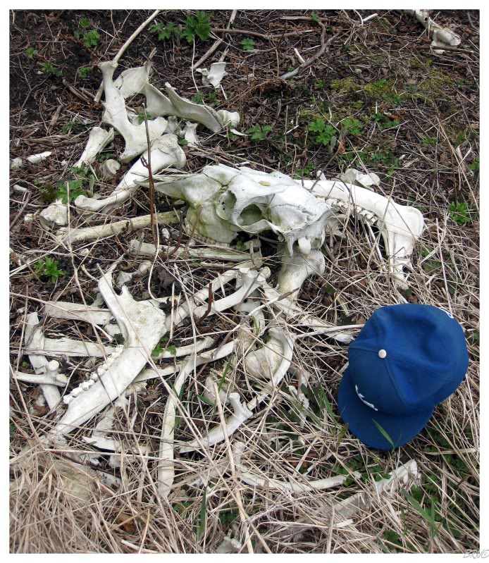
The above picture shows the embankment I threw myself up onto - where I realized that there was a moose skeleton a mere 3 feet away from the spot where I hurriedly rushed myself up out of the Fox Island River.
The next portion was quite easy as a four-wheel trail followed next to the river and northwest towards the direction we needed to go.
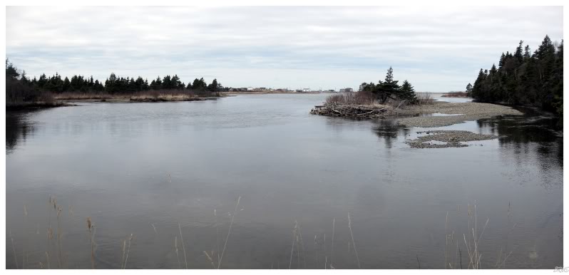
The above picture looks back over the Fox Island River to the community of Fox Island River.
We would walk beside the Fox Island River, then beside the harbour and into a farm field. After reaching this point, we noticed a cabin with a Ford F350, but weren't overly sour at apparently being able to drive, because outside of crossing the Fox Island River, this was actually enjoyable - the rest of the hike had been simple sauntering across level grassland so far.
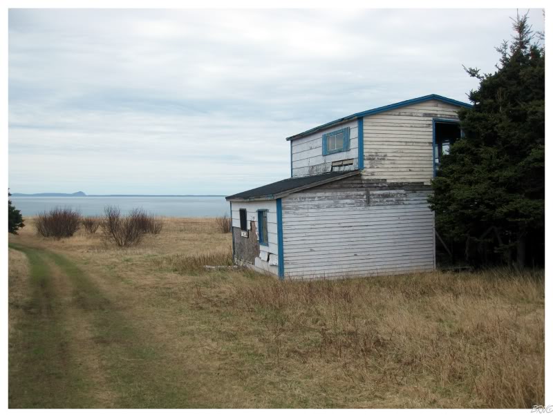
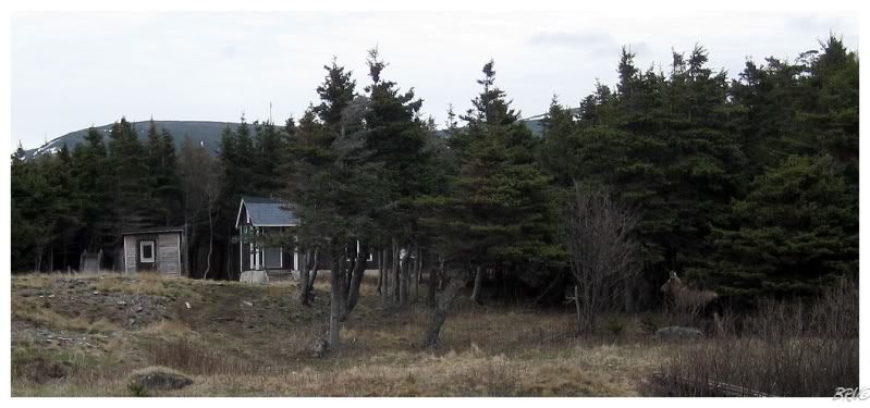
That is until we came to the above location with a cabin which neither of us concluded to be abandoned or occupied. At this point, our four-wheel trail curved and went inland, while walking straight wasn't possible because of a large cliff leading into a small pond. Looking down at the ocean, there was a sandbar, but a deep channel of water sliced it down the middle - and neither of us felt like removing clothing and fording water again.
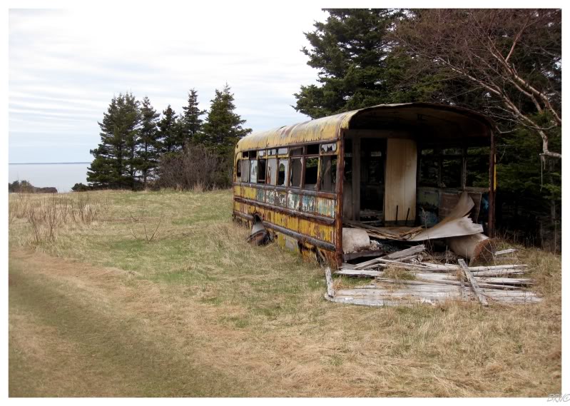
We both knew we had to follow the coast, but we followed the four-wheel trail inland for a few hundred meters instead of getting in the actual ocean. I was happy as it lead us to an abandoned house bus, but also unhappy as the trail started to hook back toward the community of Fox Island River.
Fortunately, we found a mediocre trail near the bus, which led down the cliff and to the ground below.
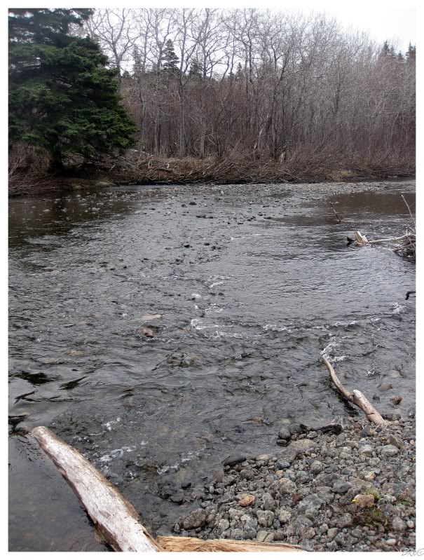
This trail lead us down to a small river, and where I had printed out the topo map for this trip, we were actually happy to find the second river because it meant that we must have covered about 3km(1.8mi) by now.
I crossed first and was fooled a bit about the river's depth, receiving a soaker for my troubles. My steel toe boots I was using for hiking were now even heavier, but thankfully it was 50 degrees, so my feet wouldn't freeze.
Not overly concerned, I was happy that we were making progress and were now one step closer to the end goal.
It was also around this point that a teenage kid on a four-wheeler drove past us and gave us a confused look. I'm quite certain he doesn't see any hikers in this area, but if he does, I'm certain he doesn't see them crossing streams during their travels in early May.
Nicole & I had a good laugh at the situation.
The river crossing would lead to a collapsed house and some more trails. Following the trail leading back to the ocean, it wasn't overly wet or boggy & I was happy with the time we were making.
Eventually we would come upon even more cabins back here and as I was admiring a particularly abandoned looking one, I looked to my left to notice a cow (female moose) staring back at me. Now this isn't as intimidating as an antlered bull moose, so I simply stood there and after the cow moose was happy with her look at me, she trotted off towards another cabin and into the woods. I stood wondering how many moose you would see if you lived in one of these cabins (Nicole grew up in a pretty dense town and said she saw approximately 5 moose a year wandering through her back yard).
Nicole was impressed with how I wasn't scared of a female moose and I came off looking like a big man, haha.
^I was too lazy to properly photoshop Nicole out of the picture
The next portion would be a lot rougher.
We were both excited as where we saw the female moose looked like the location of the third & final river. Looking at the map, it seemed we had now covered about 5km(3.2mi) and we HAD to be getting close to the 8km(5mi) lighthouses.
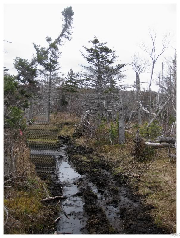
Unfortunately the trail wouldn't maintain its quality much further past those cow moose cabins. We were able to go down to the beach for some easy hiking for a bit, but eventually we were blocked by cliffs and forced inland. Inland we would find bogs and lots of mud & water; we tried to carefully step around the sloppy surface, but we both misstepped into the thick ground, wrought with water and muck (see above picture).
Eventually we found an abandoned snowmobile and relaxed for lunch. The skies started to sprinkle and the trail in front of us looked even wetter and uglier. As I consumed my spicy red pepper turkey sandwiches, I realized that the day was quickly passing and we were running out of time. The two of us concluded that we could only move forward for another hour before we would have to turn around since it would become dark in 4 or 5 hours (and it would take us at least 3 hours to get back).
Knowing we only had an hour to make forward progress, I was now pushing Nicole and determined to get her moving.
It was around this time that I noticed Fox Island (the island to the left of the coast on the topo map) moving further away on our left. I remembered an internet photo taken from Fox Island of the lighthouse...one of the only indications that the lighthouse was even there. Anyway, remembering this picture & assuming the guy didn't have a professional camera...we had to be getting close to the lighthouse? No?
Unfortunately, about an hour would pass as we reached a portion where we couldn't move any further on the beach & the trail had deteriorated considerably. Any further & it would include draconian bushwhacking and brute-force tree mashing to get to our location.
The thing I couldn't understand though, was that we had to have hiked about 8km by now.
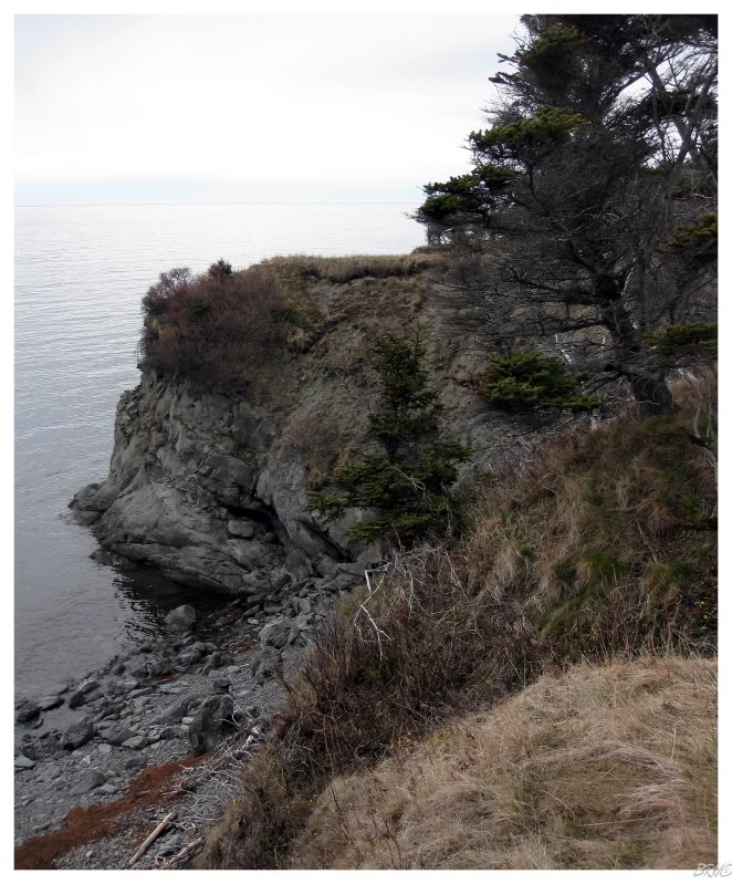
Look at the above photo. That photo is taken about a km from our furthest distance & I'm pretty damn sure it shows Broad Cove Point (the point with both of our lighthouses). If you look at a closer topo map, showing where the lighthouses are, you see that the mountains don't start much further past the lighthouses - so how are we this close without at least seeing them? Lighthouses are meant to be seen from sea, so where the f are they? Also, one of them is quite tall, why can't we see it?
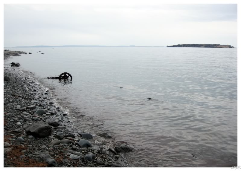
(^Either a car of wagon axle we found in the ocean on the way back)
It didn't really matter; it was getting too late & we had to turn around.
If you're wondering why I don't have a GPS for such things, realize that I'm a cheap bastard.
Nicole & I would return this September.
The weekend we returned, we had already camped the night before & hiked to another lighthouse as well. I wasn't really in the mood for another river fording 8km hike, but I figured I'd be happier if I did it then if I didn't.
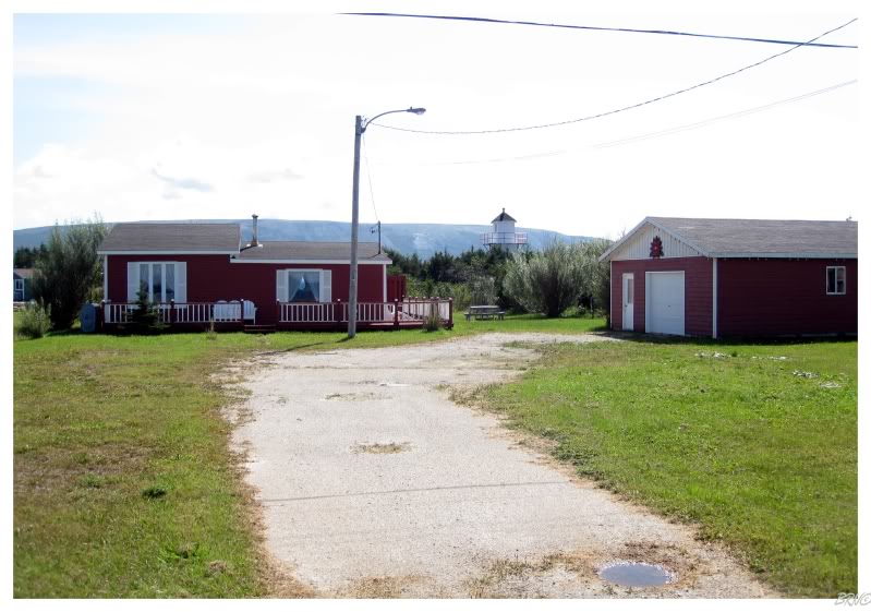
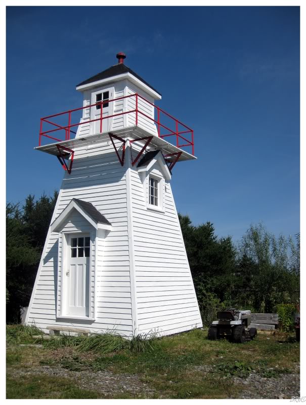
Anyway, I did notice something on the way into town...something that looked like the front lighthouse of the pair that's supposed to sit at Broad Cove Point (see above). I would drive to our parking spot from last time, but then turn around and inquire with a fisherman at the wharf in Fox Island River - and he would tell me what I suspected...
"Yeah, that's the lighthouse from up on Broad Cove Point. Yves bought it when the Coast Guard went to demolish it. Brought it piece by piece and reassembled it at his house."
"So what about the other lighthouse," I asked.
"Oh, yeah the Coast Guard demolished it. That one only survived because Yves took it."
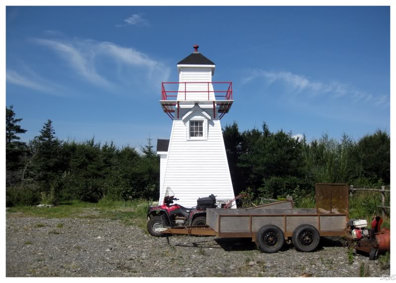
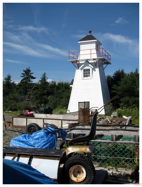
So we drove back to the saved lighthouse.
I was happy because it was looking fine & in a lot better condition than you find a lot of lighthouses, but I was also dejected because I was really excited to see the Broad Cove Rear Lighthouse.
Oh well, such is life.
I get this question a lot, if whether I'm happy to get a greater percentage when I find out a lighthouse is gone (because it's only 'out of 85' instead of 'out of 88') - the answer is no.
Maybe if you removed an ugly skeletal tower out on some rock in the Atlantic; but when you have a lighthouse I was actually excited to see? I'm not excited because my 'percentage of Newfoundland lighthouses complete' increases when it is demolished.
End.
Go Back to the Main Page of this Website.