|
View Directions to wild cove, nl in a larger map |
Wintry Baie Verte February 2010.
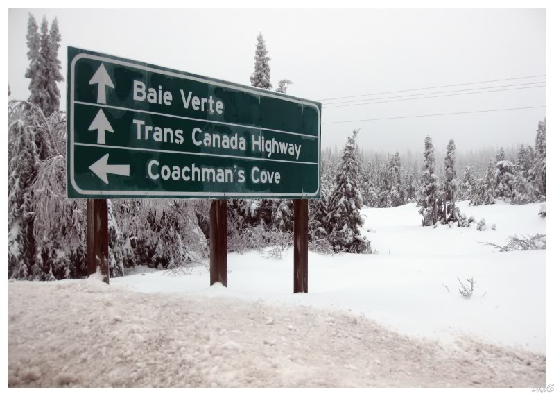
0 - Start 1 - 411 to Westport/Purbeck's Cove 2 - Baie Verte 3 - 410 to Fleur De Lys 4 - Coachman's Cove 5 - 412 to Seal Cove 6 - 419 to Wild Cove |
My friend Cheryl moved away late in 2009, and like most Newfies, grew homesick quickly. Therefore she booked a plane ticket home, even though it was a Newfoundland time everyone else avoids like the plague - the middle of the winter.
She wanted to go for a drive one day, but not an overnight trip. Evaluating my options, I decided that a trip up to the Baie Verte peninsula was in order: 90 minutes each way on the Trans Canada Highway, in addition to a sizable peninsula to explore, Baie Verte would make for an adequate day trip.
I had been to Baie Verte briefly before, but this peninsula lingered in my interest because of the amount of communities and the mining history of the region (think bigger buildings and something different besides fishing villages).
The first place we went was Westport - a place I hadn't been to before.
We were both amazed at just how rough it was, but 38km(24mi) of Highway 411 later, we had arrived.
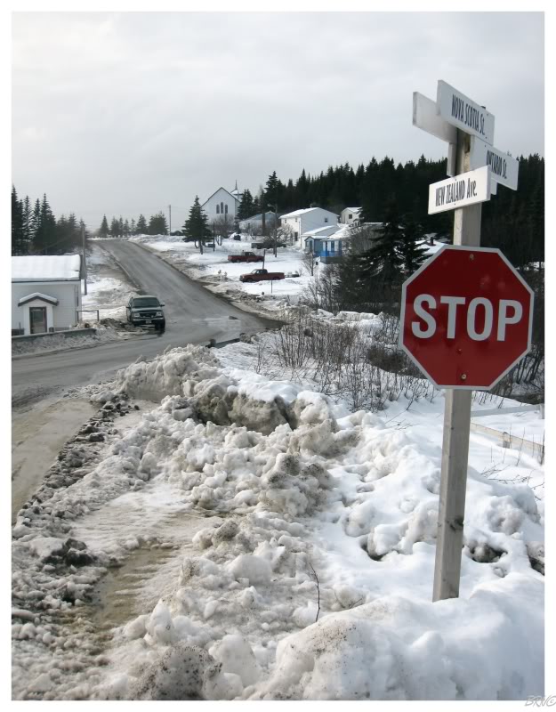
When first coming upon Westport, we thought the street names were strange, but not flabbergasting - Nova Scotia St., New Brunswick Cr., Kentucky Avenue? Then came the New Zealand Street and the Ireland Avenue! We figured someone had quite the case of travellust - and quite the disrespect for geographic level consistency - when naming the streets of this village.
Typically the streets of Newfoundland are named after trees (Alder, Maple, Elm St.) or structures (Church, Cemetery, Elementary School St.), so Westport was a pleasing change.
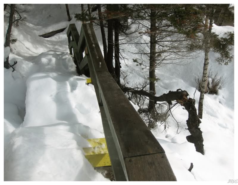
Westport is a place with maybe 60 houses, so we quickly covered all of their geographic streets. We moved towards the wharf and to the nearby hiking trail to the lighthouse.
Unfortunately, it didn't even cross my mind to bring hiking shoes as it was winter. Fortunately, we had been having a particularly weak winter and I was able to make due with my skate sneakers.
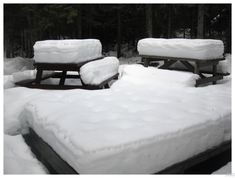
The lighthouse trail isn't very long, but there was an interesting sheltered area where such minimal wind reached that the snow atop the picnic tables looked like ice cream sandwich centres.
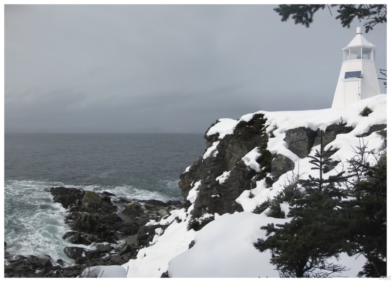
The majestic Westport Cove Lighthouse!
Constructed in 1906, Westport stands only 9 feet tall, but is seen as a greater height because of the cliff upon which it is located.
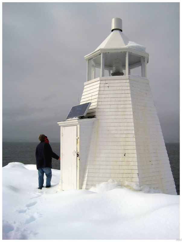
The website I use for my lighthouse information tells me that this lighthouse is a good candidate for Canada's smallest - and I can't really argue with that...she's just a little guy.
In regards to the future, I have to reason that this lighthouse doesn't provide much navigation value anymore as this economic section of White Bay has shrunk; but thankfully, I can't imagine Westport's lighthouse requires much maintenance either.
It also provides people with motivation to visit Westport when on the Baie Verte - and to show Westport support, Cheryl and I went out of our way to purchase drinks and snacks at Westport's house-like convenience store on Nova Scotia Street while in the community.
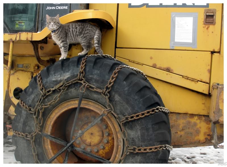
A mere 6km from Westport, via gravel road, lies the community of Purbeck's Cove. I'm always excited about visiting every single place on the map...and when Cheryl said she wanted to go as well...well then it was on: we would be navigating that hilly, pothole-rich, snowy gravel road in her poor dad's car.
Purbeck's Cove ended up having about 15 houses and I took a picture of this cat which climbed up on some chained tires to check us out.
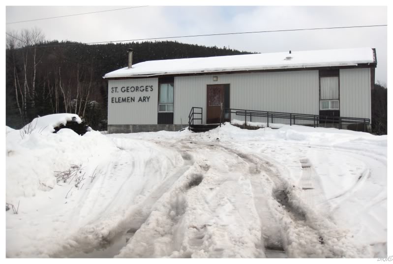
I also took a picture of the former school, but about 5 of the 20 townspeople were watching us simply as we stopped for this picture.
If you want interior pictures, I'll give you directions and sunrise times...you can have fun pre-dawning a 3 room schoolhouse.
Next we went to Fleur De Lys...but that's been covered here before.
So yes, I've already taken pictures in Fleur De Lys, but it was neat to see the picturesque decaying fishing stage in another time and another season. In addition, I enjoyed Fleur De Lys enough the first time, to have gone there a second time so my friend could see it.
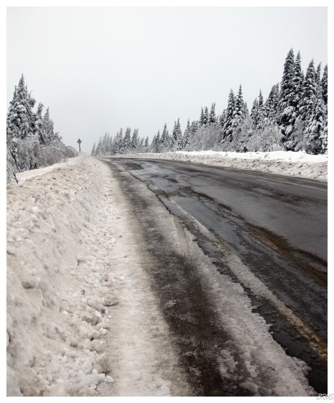
The drive to Fleur De Lys was more interesting than expected, because contrary to the day's primary conditions of melting snow and sun; there was a short section of Highway 410 where it was suddenly dim, cold and silent. It was within this area that everything had an inch of ice on it and you would infrequently hear the snapping of tree branches beneath the weight of ice. Otherwise, this area was mostly silent, other than the occasional frozen tree branches clicking together - like baseball cards in bicycle spokes.
It's funny that traveling that stretch of highway became the highlight and most memorable incident from this trip.
We covered Highways 410 (Fleur De Lys) and 411 (Westport) quicker then we anticipated, so we decided to check off Highway 412 while in the area as well.
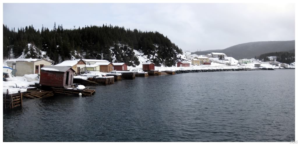
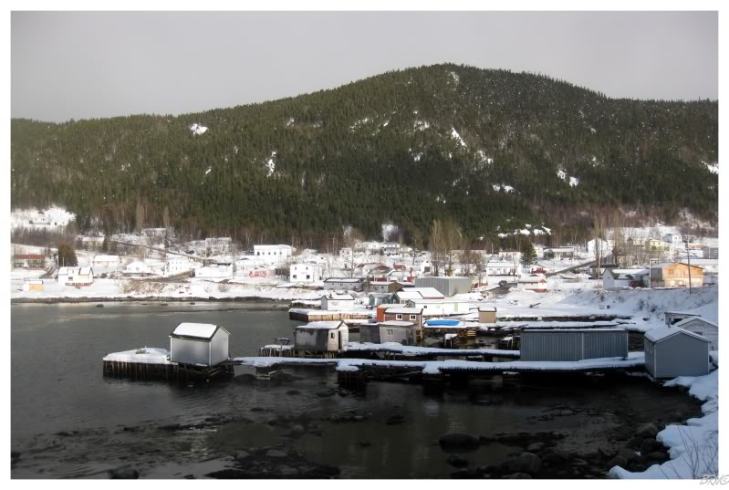
Highway 412 leads to the community of Seal Cove.
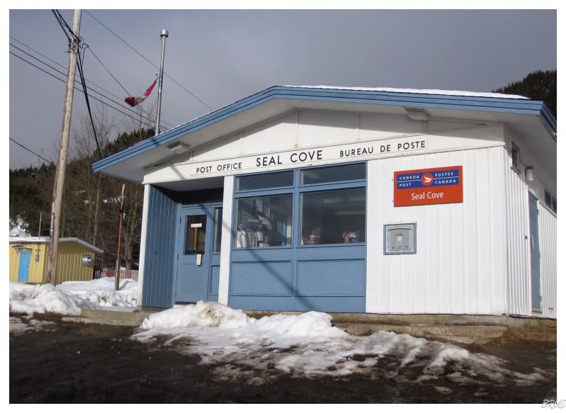
While my crumby panoramic photo doesn't make Seal Cove seem like much, it was actually very nice as you drove through the mountains and suddenly there was a road which dropped down to a village around the water of White Bay.
I also liked the old school post office in Westport, complete with the 60s-tastic font indicating the building's purpose - I've only seen one other post office like this in Newfoundland and I'm curious if they were all like this? Or at least some?
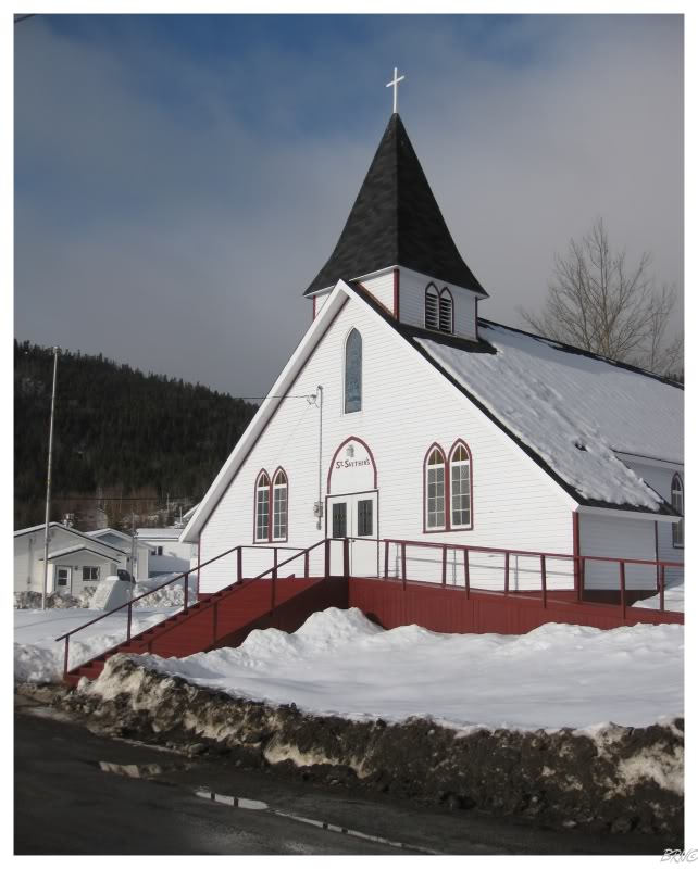
An interesting church as well...
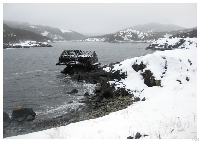
Highway 419 branches off Highway 412, and since we were already all the way up here, we decided to simply get it done and check out that highway and its village of Wild Cove.
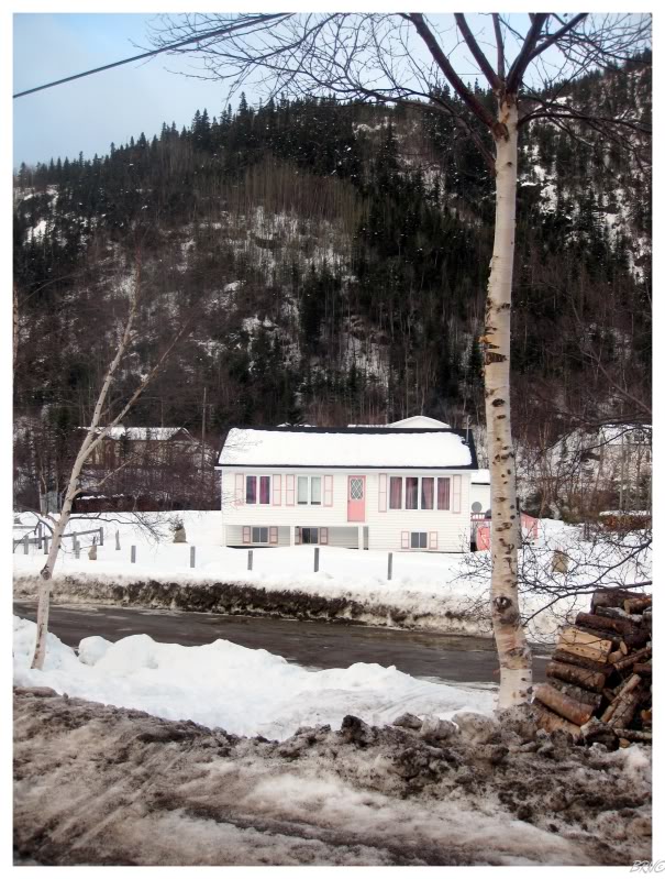
I remember there being a really interesting fishing stage and a basketball hoop attached to the side of a decaying fishing shack...but for some reason I took a picture of a peach house.
Maybe it was time to go home more so than I imagined.